Approximate Location Map
Large Map »
Latitude: 54.011 / 54°0'39"N
Longitude: -0.4397 / 0°26'22"W
OS Eastings: 502346
OS Northings: 458352
OS Grid: TA023583
Mapcode National: GBR TQC1.LX
Mapcode Global: WHGDC.6FWX
Plus Code: 9C6X2H66+C4
Entry Name: Pinfold Approximately 65 Metres East of Highfield Country Club
Listing Date: 25 January 1985
Grade: II
Source: Historic England
Source ID: 1083342
English Heritage Legacy ID: 166894
ID on this website: 101083342
Location: Driffield, East Riding of Yorkshire, YO25
County: East Riding of Yorkshire
Civil Parish: Driffield
Built-Up Area: Driffield
Traditional County: Yorkshire
Lieutenancy Area (Ceremonial County): East Riding of Yorkshire
Church of England Parish: Great Driffield All Saints
Church of England Diocese: York
Tagged with: Building
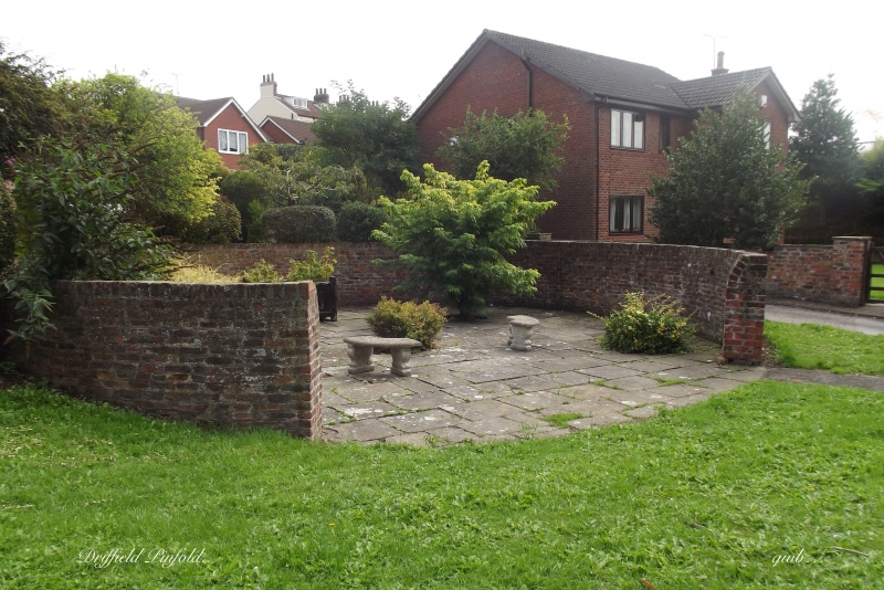
TA 02 58 DRIFFIELD WINDMILL HILL
12/35 Pinfold approximately
65 metres east of
Highfield Country Club
- II
Pinfold. Mid C19. Brick. Circular structure, approximately 13 metres in
diameter, with entrance to south-west.
Listing NGR: TA0234658352
External links are from the relevant listing authority and, where applicable, Wikidata. Wikidata IDs may be related buildings as well as this specific building. If you want to add or update a link, you will need to do so by editing the Wikidata entry.


Other nearby listed buildings
