Approximate Location Map
Large Map »
Latitude: 53.8393 / 53°50'21"N
Longitude: -0.423 / 0°25'22"W
OS Eastings: 503862
OS Northings: 439264
OS Grid: TA038392
Mapcode National: GBR TSH1.6G
Mapcode Global: WHGF4.GRSM
Plus Code: 9C5XRHQG+PQ
Entry Name: 5-9, Flemingate
Listing Date: 30 June 1987
Grade: II
Source: Historic England
Source ID: 1310557
English Heritage Legacy ID: 167147
ID on this website: 101310557
Location: Beverley, East Riding of Yorkshire, HU17
County: East Riding of Yorkshire
Civil Parish: Beverley
Built-Up Area: Beverley
Traditional County: Yorkshire
Lieutenancy Area (Ceremonial County): East Riding of Yorkshire
Church of England Parish: Beverley Minster St John and St Martin
Church of England Diocese: York
Tagged with: Building
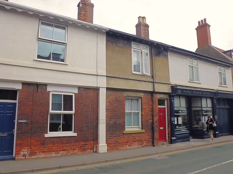
BEVERLEY FLEMINGATE
TA 0339 (north side)
10/50
- Nos 5 to 9 (odd)
GV II
C16 or C17. Timber framed but refronted, with slate roof. 2 storeys,
render on brick. 4 modern windows over 2 and a late C19 shop front.
Listing NGR: TA0386239264
External links are from the relevant listing authority and, where applicable, Wikidata. Wikidata IDs may be related buildings as well as this specific building. If you want to add or update a link, you will need to do so by editing the Wikidata entry.


Other nearby listed buildings
