Approximate Location Map
Large Map »
Latitude: 53.8375 / 53°50'15"N
Longitude: -0.4291 / 0°25'44"W
OS Eastings: 503465
OS Northings: 439065
OS Grid: TA034390
Mapcode National: GBR TSF2.W2
Mapcode Global: WHGF4.CSWY
Plus Code: 9C5XRHQC+28
Entry Name: 59, Keldgate
Listing Date: 16 May 1984
Grade: II
Source: Historic England
Source ID: 1084037
English Heritage Legacy ID: 167209
ID on this website: 101084037
Location: Beverley, East Riding of Yorkshire, HU17
County: East Riding of Yorkshire
Civil Parish: Beverley
Built-Up Area: Beverley
Traditional County: Yorkshire
Lieutenancy Area (Ceremonial County): East Riding of Yorkshire
Church of England Parish: Beverley Minster St John and St Martin
Church of England Diocese: York
Tagged with: Building
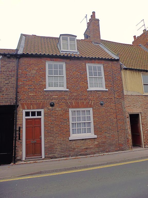
BEVERLEY KELDGATE
TA 0339 (south side)
8/109
No 59
16.5.84
GV II
Second half of C18. 2 storeys in brick with pantile roof with 1 dormer. 2 win-
dows, brick voussoirs, hung sashes with glazing bars, 1 to ground and 4-panel
door with 3-light fanlight.
Listing NGR: TA0346539065
External links are from the relevant listing authority and, where applicable, Wikidata. Wikidata IDs may be related buildings as well as this specific building. If you want to add or update a link, you will need to do so by editing the Wikidata entry.


Other nearby listed buildings
