Approximate Location Map
Large Map »
Latitude: 53.8438 / 53°50'37"N
Longitude: -0.4326 / 0°25'57"W
OS Eastings: 503223
OS Northings: 439755
OS Grid: TA032397
Mapcode National: GBR TRFZ.4V
Mapcode Global: WHGF4.BN74
Plus Code: 9C5XRHV8+GX
Entry Name: 11, Ladygate
Listing Date: 15 April 1980
Grade: II
Source: Historic England
Source ID: 1161490
English Heritage Legacy ID: 167227
ID on this website: 101161490
Location: Beverley, East Riding of Yorkshire, HU17
County: East Riding of Yorkshire
Civil Parish: Beverley
Built-Up Area: Beverley
Traditional County: Yorkshire
Lieutenancy Area (Ceremonial County): East Riding of Yorkshire
Church of England Parish: Beverley St Mary
Church of England Diocese: York
Tagged with: Building
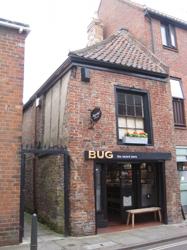
TA 0339 BEVERLEY LADYGATE
(east side)
9/127 No 11
15.4.80
GV II
Medieval. Timber-framed. Brick cladding. Hipped pantile roof. Two storeys.
End elevation has first floor loading door and garage door on ground floor.
Listing NGR: TA0322339755
External links are from the relevant listing authority and, where applicable, Wikidata. Wikidata IDs may be related buildings as well as this specific building. If you want to add or update a link, you will need to do so by editing the Wikidata entry.


Other nearby listed buildings
