Approximate Location Map
Large Map »
Latitude: 53.8413 / 53°50'28"N
Longitude: -0.4356 / 0°26'8"W
OS Eastings: 503033
OS Northings: 439472
OS Grid: TA030394
Mapcode National: GBR TSD0.HR
Mapcode Global: WHGF4.8QT2
Plus Code: 9C5XRHR7+GQ
Entry Name: Garden Wall to No 31
Listing Date: 30 June 1987
Grade: II
Source: Historic England
Source ID: 1162137
English Heritage Legacy ID: 167297
ID on this website: 101162137
Location: Beverley, East Riding of Yorkshire, HU17
County: East Riding of Yorkshire
Civil Parish: Beverley
Built-Up Area: Beverley
Traditional County: Yorkshire
Lieutenancy Area (Ceremonial County): East Riding of Yorkshire
Church of England Parish: Beverley St Mary
Church of England Diocese: York
Tagged with: Wall
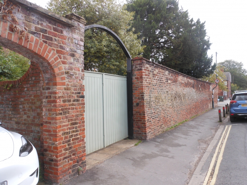
TA 0339 BEVERLEY NEWBEGIN
(south side)
9/186 Garden wall to No 31
GV II
C18 garden wall, about three metres high. Brick with stone coping.
Listing NGR: TA0303339472
External links are from the relevant listing authority and, where applicable, Wikidata. Wikidata IDs may be related buildings as well as this specific building. If you want to add or update a link, you will need to do so by editing the Wikidata entry.


Other nearby listed buildings
