Approximate Location Map
Large Map »
Latitude: 53.8424 / 53°50'32"N
Longitude: -0.4337 / 0°26'1"W
OS Eastings: 503152
OS Northings: 439599
OS Grid: TA031395
Mapcode National: GBR TSD0.WB
Mapcode Global: WHGF4.9PQ6
Plus Code: 9C5XRHR8+XG
Entry Name: Gatepiers to No 10 and Gates
Listing Date: 30 June 1987
Grade: II
Source: Historic England
Source ID: 1084033
English Heritage Legacy ID: 167302
ID on this website: 101084033
Location: Beverley, East Riding of Yorkshire, HU17
County: East Riding of Yorkshire
Civil Parish: Beverley
Built-Up Area: Beverley
Traditional County: Yorkshire
Lieutenancy Area (Ceremonial County): East Riding of Yorkshire
Church of England Parish: Beverley St Mary
Church of England Diocese: York
Tagged with: Gatepost
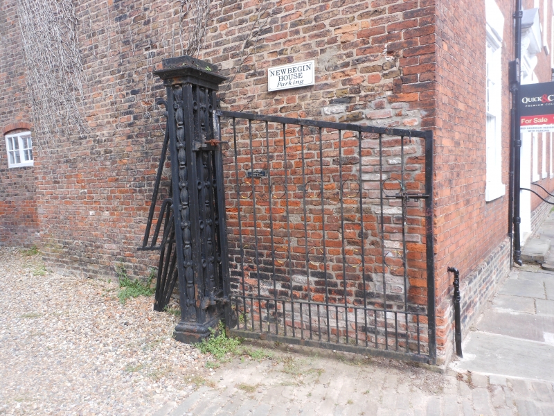
TA 0339 BEVERLEY NEWBEGIN
(north side)
9/191 Gatepiers to No 10 and
gates
GV II
Quadrant wall to west of No 10: brick. Early C19 iron gatepiers and gates
on east side.
Listing NGR: TA0315239599
External links are from the relevant listing authority and, where applicable, Wikidata. Wikidata IDs may be related buildings as well as this specific building. If you want to add or update a link, you will need to do so by editing the Wikidata entry.


Other nearby listed buildings
