Approximate Location Map
Large Map »
Latitude: 53.842 / 53°50'31"N
Longitude: -0.431 / 0°25'51"W
OS Eastings: 503330
OS Northings: 439553
OS Grid: TA033395
Mapcode National: GBR TSF0.GH
Mapcode Global: WHGF4.BPZK
Plus Code: 9C5XRHR9+QH
Entry Name: 14, Toll Gavel
Listing Date: 2 July 1969
Grade: II
Source: Historic England
Source ID: 1164303
English Heritage Legacy ID: 167486
ID on this website: 101164303
Location: Beverley, East Riding of Yorkshire, HU17
County: East Riding of Yorkshire
Civil Parish: Beverley
Built-Up Area: Beverley
Traditional County: Yorkshire
Lieutenancy Area (Ceremonial County): East Riding of Yorkshire
Church of England Parish: Beverley St Mary
Church of England Diocese: York
Tagged with: Building
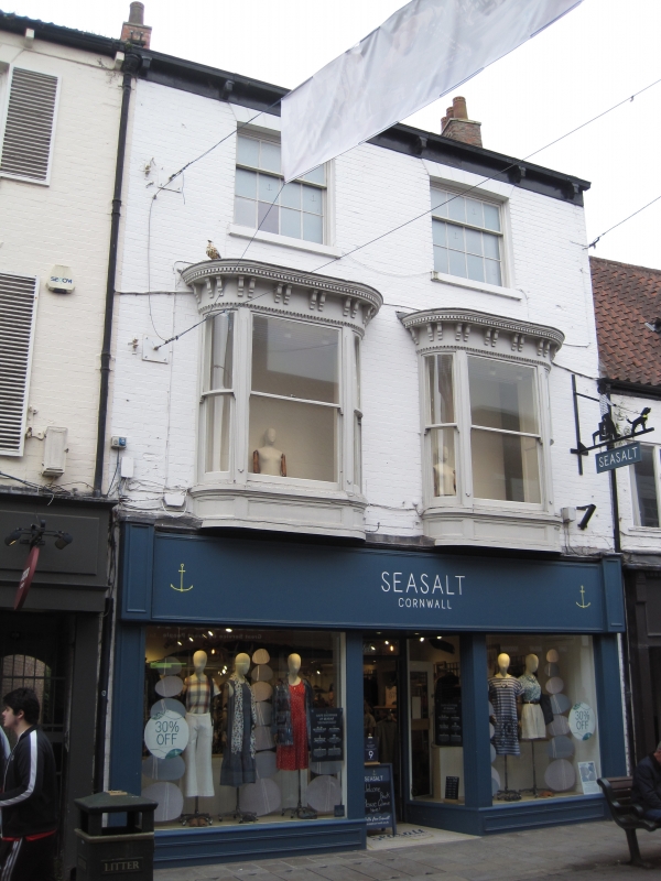
BEVERLEY TOLL GAVEL
TA 0339 (south side)
9/359
No 14
2.7.69
GV II
Early C19. 3 storeys in painted brick with slate roof. 2 windows, near
flush frame sashes with glazing bars and voussoirs to flat arches. Canted
rounded bay to first floor with sash windows, wood cases, carved bracketed
entablature. Modern shop front to ground floor.
Listing NGR: TA0333039553
External links are from the relevant listing authority and, where applicable, Wikidata. Wikidata IDs may be related buildings as well as this specific building. If you want to add or update a link, you will need to do so by editing the Wikidata entry.


Other nearby listed buildings
