Approximate Location Map
Large Map »
Latitude: 53.8421 / 53°50'31"N
Longitude: -0.4285 / 0°25'42"W
OS Eastings: 503495
OS Northings: 439571
OS Grid: TA034395
Mapcode National: GBR TSG0.0G
Mapcode Global: WHGF4.DP5G
Plus Code: 9C5XRHRC+RH
Entry Name: 115, Walkergate
Listing Date: 12 November 1986
Grade: II
Source: Historic England
Source ID: 1083916
English Heritage Legacy ID: 167513
ID on this website: 101083916
Location: Beverley, East Riding of Yorkshire, HU17
County: East Riding of Yorkshire
Civil Parish: Beverley
Built-Up Area: Beverley
Traditional County: Yorkshire
Lieutenancy Area (Ceremonial County): East Riding of Yorkshire
Church of England Parish: Beverley St Mary
Church of England Diocese: York
Tagged with: Building
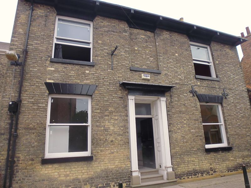
TA 0339 BEVERLEY WALKERGATE
(east side)
9/382
No 115
12.11.86
GV II
Early-mid c19. 2 storeys in white brick with slate roof and brackets at eaves.
3 windows, the centre blocked, rendered lintels, no glazing bars. Doorway with
moulded pilasters, entablature and cornice. Panelled reveals and soffit matching
6-panel door, rectangular fanlight.
Listing NGR: TA0349539571
External links are from the relevant listing authority and, where applicable, Wikidata. Wikidata IDs may be related buildings as well as this specific building. If you want to add or update a link, you will need to do so by editing the Wikidata entry.


Other nearby listed buildings
