Approximate Location Map
Large Map »
Latitude: 53.8412 / 53°50'28"N
Longitude: -0.4275 / 0°25'39"W
OS Eastings: 503562
OS Northings: 439476
OS Grid: TA035394
Mapcode National: GBR TSG0.7S
Mapcode Global: WHGF4.DQN3
Plus Code: 9C5XRHRC+FX
Entry Name: 2, 4, 6, Well Lane
Listing Date: 28 May 1985
Grade: II
Source: Historic England
Source ID: 1083924
English Heritage Legacy ID: 167535
ID on this website: 101083924
Location: Beverley, East Riding of Yorkshire, HU17
County: East Riding of Yorkshire
Civil Parish: Beverley
Built-Up Area: Beverley
Traditional County: Yorkshire
Lieutenancy Area (Ceremonial County): East Riding of Yorkshire
Church of England Parish: Beverley Minster St John and St Martin
Church of England Diocese: York
Tagged with: Building
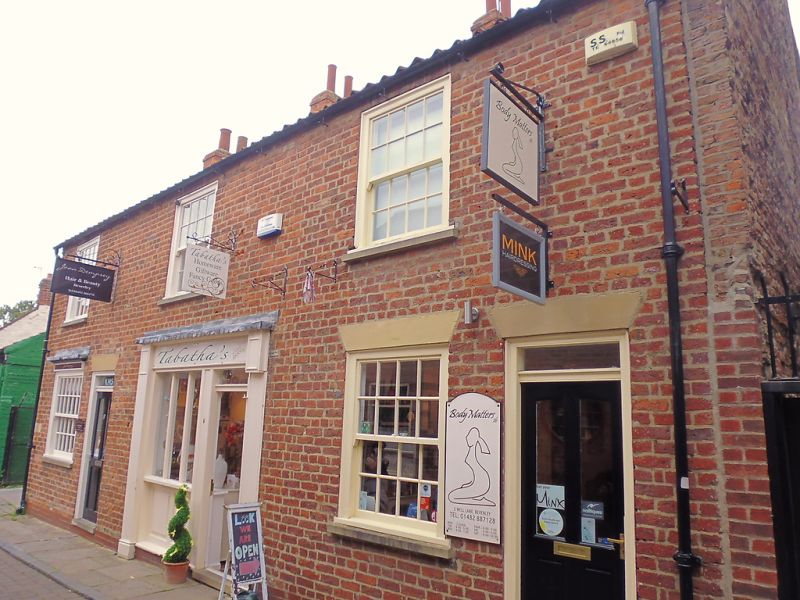
BEVERLEY WELL LANE
TA 0339 (north side)
10/405
Nos 2, 4 and 6
28.5.85
GV II
Early C19. Brown brick. Pantiled roof. 2 storeys. Three bays: sashes
with glazing bars. Three doors with oblong fanlights.
Listing NGR: TA0356239476
External links are from the relevant listing authority and, where applicable, Wikidata. Wikidata IDs may be related buildings as well as this specific building. If you want to add or update a link, you will need to do so by editing the Wikidata entry.


Other nearby listed buildings
