Approximate Location Map
Large Map »
Latitude: 51.1263 / 51°7'34"N
Longitude: 0.26 / 0°15'36"E
OS Eastings: 558244
OS Northings: 138767
OS Grid: TQ582387
Mapcode National: GBR MPZ.6L7
Mapcode Global: VHHQD.GY9F
Plus Code: 9F3247G6+G2
Entry Name: Wall in Front of Nos 4 and 5
Listing Date: 7 June 1974
Grade: II
Source: Historic England
Source ID: 1338820
English Heritage Legacy ID: 167974
ID on this website: 101338820
Location: Royal Tunbridge Wells, Tunbridge Wells, Kent, TN1
County: Kent
District: Tunbridge Wells
Electoral Ward/Division: Pantiles and St Mark's
Parish: Non Civil Parish
Built-Up Area: Royal Tunbridge Wells
Traditional County: Kent
Lieutenancy Area (Ceremonial County): Kent
Church of England Parish: Tunbridge Wells King Charles the Martyr
Church of England Diocese: Rochester
Tagged with: Wall
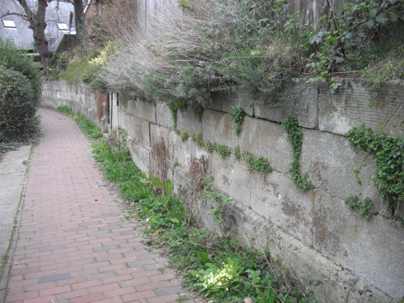
CUMBERLAND WALK
1.
1746
Wall in front of
Nos 4 and 5
TQ 5838 NW 1/173
II
2.
Early C19. A wall of Tunbridge Wells stone about 5 ft in height - Plinth.
Listing NGR: TQ5824238771
External links are from the relevant listing authority and, where applicable, Wikidata. Wikidata IDs may be related buildings as well as this specific building. If you want to add or update a link, you will need to do so by editing the Wikidata entry.


Other nearby listed buildings
