Approximate Location Map
Large Map »
Latitude: 51.0952 / 51°5'42"N
Longitude: 0.5302 / 0°31'48"E
OS Eastings: 577270
OS Northings: 135921
OS Grid: TQ772359
Mapcode National: GBR PTC.8VQ
Mapcode Global: FRA D607.6DB
Plus Code: 9F323GWJ+33
Entry Name: Napier Cottage
Listing Date: 19 May 1986
Grade: II
Source: Historic England
Source ID: 1065718
English Heritage Legacy ID: 169007
ID on this website: 101065718
Location: Cranbrook, Tunbridge Wells, Kent, TN17
County: Kent
District: Tunbridge Wells
Civil Parish: Cranbrook & Sissinghurst
Built-Up Area: Cranbrook
Traditional County: Kent
Lieutenancy Area (Ceremonial County): Kent
Tagged with: Cottage
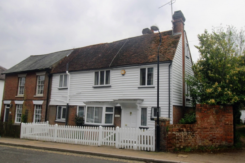
CRANBROOK HIGH STREET
TQ 7735 NW
(south side)
11/158
- Napier Cottage
GV II
Cottage. C18. Timber framed with painted brick ground floor and weather
boarded first floor. Plain tiled roof. 2 storeys and garrets. 3 windows
front, C19 and C20 casements with small square bay on ground floor to right.
Boarded door in centre. Interior: Some framing of thinscantling visible.
Included for group value only.
Listing NGR: TQ7727035921
External links are from the relevant listing authority and, where applicable, Wikidata. Wikidata IDs may be related buildings as well as this specific building. If you want to add or update a link, you will need to do so by editing the Wikidata entry.


Other nearby listed buildings
