Approximate Location Map
Large Map »
Latitude: 51.1719 / 51°10'18"N
Longitude: 0.2743 / 0°16'27"E
OS Eastings: 559084
OS Northings: 143869
OS Grid: TQ590438
Mapcode National: GBR MPD.J4S
Mapcode Global: VHHQ6.PSVZ
Plus Code: 9F3257CF+QP
Entry Name: Moat Farmhouse
Listing Date: 10 December 1986
Grade: II
Source: Historic England
Source ID: 1338686
English Heritage Legacy ID: 169346
ID on this website: 101338686
Location: Tunbridge Wells, Kent, TN11
County: Kent
District: Tunbridge Wells
Civil Parish: Southborough
Traditional County: Kent
Lieutenancy Area (Ceremonial County): Kent
Church of England Parish: Southborough St Thomas
Church of England Diocese: Rochester
Tagged with: Farmhouse
SOUTHBOROUGH VAUXHALL LANE
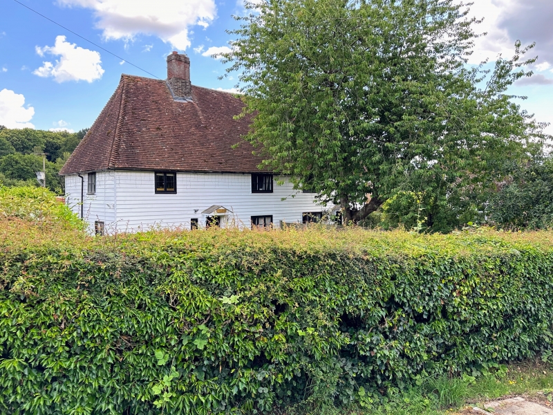
1/25 Moat Farmhouse
-
- II
C17 farmhouse, now 2 cottages. Weather-boarded with plain tiled roof, hipped to
east, half-hipped to west. 2 storeys, 4-window front with casement windows.
Small trellised wooden porch with gable.
Listing NGR: TQ5789543342
External links are from the relevant listing authority and, where applicable, Wikidata. Wikidata IDs may be related buildings as well as this specific building. If you want to add or update a link, you will need to do so by editing the Wikidata entry.


Other nearby listed buildings
