Approximate Location Map
Large Map »
Latitude: 51.1716 / 51°10'17"N
Longitude: 0.2738 / 0°16'25"E
OS Eastings: 559056
OS Northings: 143836
OS Grid: TQ590438
Mapcode National: GBR MPD.J1L
Mapcode Global: VHHQ6.PTM5
Plus Code: 9F3257CF+MG
Entry Name: Barn 30 Yards West of Moat Farmhouse
Listing Date: 10 December 1986
Grade: II
Source: Historic England
Source ID: 1372048
English Heritage Legacy ID: 169347
ID on this website: 101372048
Location: Tunbridge Wells, Kent, TN11
County: Kent
District: Tunbridge Wells
Civil Parish: Southborough
Traditional County: Kent
Lieutenancy Area (Ceremonial County): Kent
Church of England Parish: Southborough St Thomas
Church of England Diocese: Rochester
Tagged with: Barn
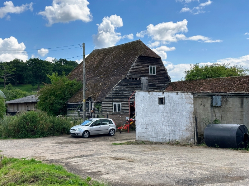
SOUTHBOROUGH VAUXHALL LANE
1/24 Barn 30 yards west of
- Moat Farmhouse
- II
Mid C19 barn. Brick plinth, weather-boarded above. Tiled half-hipped roof.
5 bays; north wagon entrance. Catslide roof to east.
Listing NGR: TQ5789543342
External links are from the relevant listing authority and, where applicable, Wikidata. Wikidata IDs may be related buildings as well as this specific building. If you want to add or update a link, you will need to do so by editing the Wikidata entry.


Other nearby listed buildings
