Approximate Location Map
Large Map »
Latitude: 51.0392 / 51°2'21"N
Longitude: 0.5027 / 0°30'9"E
OS Eastings: 575557
OS Northings: 129634
OS Grid: TQ755296
Mapcode National: GBR PTX.MYL
Mapcode Global: FRA C6YC.MP3
Plus Code: 9F322GQ3+M3
Entry Name: Howes Cottages
Listing Date: 22 June 1989
Grade: II
Source: Historic England
Source ID: 1111781
English Heritage Legacy ID: 169795
ID on this website: 101111781
Location: The Moor, Tunbridge Wells, Kent, TN18
County: Kent
District: Tunbridge Wells
Civil Parish: Hawkhurst
Built-Up Area: Hawkhurst
Traditional County: Kent
Lieutenancy Area (Ceremonial County): Kent
Tagged with: Cottage
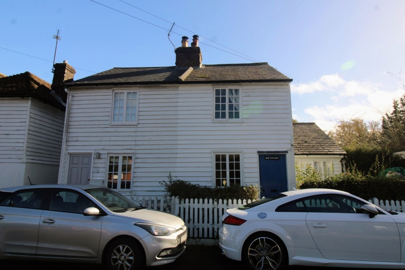
HAWKHURST TALBOT ROAD
TQ 7429-7529 (east side)
18/444 Nos 1 and 2 Howes
Cottages
GV II
Cottage pair. Dated 1837. Timber framed and weather-boarded with slate roof.
Two storeys with central stack. Regular fenestration of 2 wooden casements on
each floor, with panelled doors to left and to right. Datestone set into stack
inscribed: R H 1837. Included for group value.
Listing NGR: TQ7555529636
External links are from the relevant listing authority and, where applicable, Wikidata. Wikidata IDs may be related buildings as well as this specific building. If you want to add or update a link, you will need to do so by editing the Wikidata entry.


Other nearby listed buildings
