Approximate Location Map
Large Map »
Latitude: 51.1299 / 51°7'47"N
Longitude: 0.4115 / 0°24'41"E
OS Eastings: 568828
OS Northings: 139498
OS Grid: TQ688394
Mapcode National: GBR NRH.2TR
Mapcode Global: VHJMY.2VWQ
Plus Code: 9F324CH6+XH
Entry Name: Barn About 15 Metres East of Ruck Farmhouse
Listing Date: 10 October 1989
Grade: II
Source: Historic England
Source ID: 1084542
English Heritage Legacy ID: 169925
ID on this website: 101084542
Location: Hazel Street, Tunbridge Wells, Kent, TN12
County: Kent
District: Tunbridge Wells
Civil Parish: Horsmonden
Traditional County: Kent
Lieutenancy Area (Ceremonial County): Kent
Church of England Parish: Horsmonden St Margaret
Church of England Diocese: Rochester
Tagged with: Barn
HORSMONDEN MARLE PLACE ROAD
TQ 63 NE
(south side)
3/89 Barn about 15 metres east
of Tuck Farmhouse
GV II
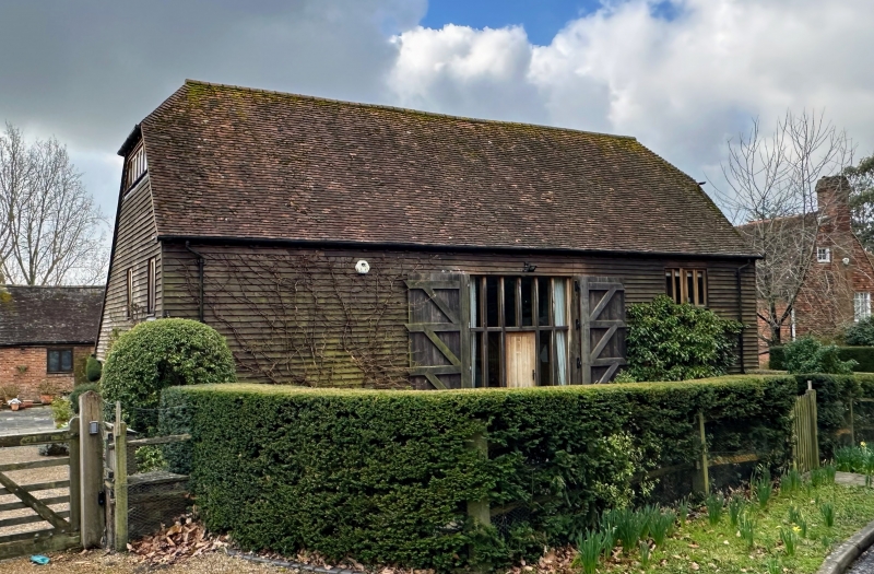
Barn. C18. Timber framed and weather boarded on red brick base with plain tiled
roof. Large 5 bay half-hipped barn with central full height cart doors, 2 wooden
casements and half-door to end right; used as garaging and farm office.
Listing NGR: TQ6855139521
External links are from the relevant listing authority and, where applicable, Wikidata. Wikidata IDs may be related buildings as well as this specific building. If you want to add or update a link, you will need to do so by editing the Wikidata entry.


Other nearby listed buildings
