Approximate Location Map
Large Map »
Latitude: 51.1036 / 51°6'12"N
Longitude: 0.365 / 0°21'54"E
OS Eastings: 565673
OS Northings: 136471
OS Grid: TQ656364
Mapcode National: GBR NRM.P45
Mapcode Global: VHJN3.8JTB
Plus Code: 9F324938+C2
Entry Name: Bridge over River Teise at TQ 657 365
Listing Date: 10 October 1989
Grade: II
Source: Historic England
Source ID: 1084522
English Heritage Legacy ID: 169977
ID on this website: 101084522
Location: Hook Green, Tunbridge Wells, Kent, TN3
County: Kent
District: Tunbridge Wells
Civil Parish: Lamberhurst
Traditional County: Sussex
Lieutenancy Area (Ceremonial County): Kent
Church of England Parish: Lamberhurst St Mary
Church of England Diocese: Rochester
Tagged with: Bridge
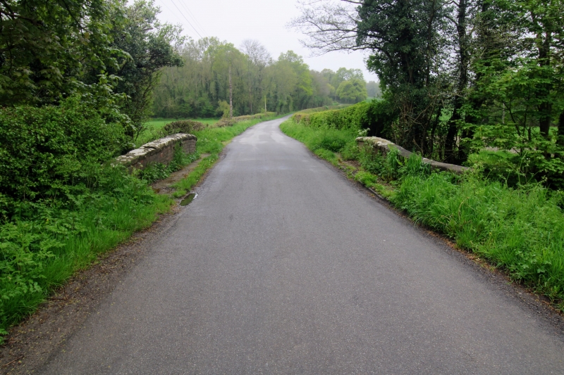
LAMBERHURST CLAY HILL ROAD
TQ 63 NE
3/140 Bridge over River Teise at
TQ 657 365
GV II
Bridge. late C18. Red brick with stone coping. Single brick arch, with plat
band to parapet walls, prominently curved and terminated by brick piers.
Parapet and side walls splayed on plan.
Listing NGR: TQ6567336470
External links are from the relevant listing authority and, where applicable, Wikidata. Wikidata IDs may be related buildings as well as this specific building. If you want to add or update a link, you will need to do so by editing the Wikidata entry.


Other nearby listed buildings
