Approximate Location Map
Large Map »
Latitude: 51.0669 / 51°4'0"N
Longitude: 0.5816 / 0°34'53"E
OS Eastings: 580976
OS Northings: 132897
OS Grid: TQ809328
Mapcode National: GBR PTT.3VK
Mapcode Global: FRA D639.GDG
Plus Code: 9F323H8J+PJ
Entry Name: Nos 3 4 5 Outbuilding to Rear
Listing Date: 5 July 1993
Grade: II
Source: Historic England
Source ID: 1085192
English Heritage Legacy ID: 170236
ID on this website: 101085192
Location: Benenden, Tunbridge Wells, Kent, TN17
County: Kent
District: Tunbridge Wells
Civil Parish: Benenden
Built-Up Area: Benenden
Traditional County: Kent
Lieutenancy Area (Ceremonial County): Kent
Tagged with: Building
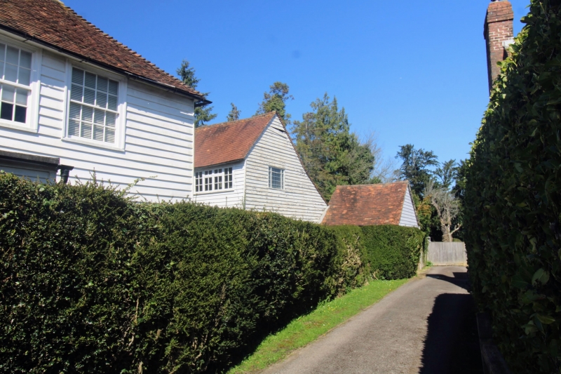
BENENDEN
TQ8032 THE STREET
1350-0/7/142 (North East side)
Nos.3,4,5
Outbuilding to Rear
GV II
Outbuilding. Late C18. Weatherboarded building with tiled
roof. 2 storeys. 3 C20 casements. Loading door to 1st floor.
Listing NGR: TQ8097632897
External links are from the relevant listing authority and, where applicable, Wikidata. Wikidata IDs may be related buildings as well as this specific building. If you want to add or update a link, you will need to do so by editing the Wikidata entry.


Other nearby listed buildings
