Approximate Location Map
Large Map »
Latitude: 51.0672 / 51°4'1"N
Longitude: 0.5795 / 0°34'46"E
OS Eastings: 580830
OS Northings: 132926
OS Grid: TQ808329
Mapcode National: GBR PTT.39Z
Mapcode Global: FRA D639.FLX
Plus Code: 9F323H8H+VR
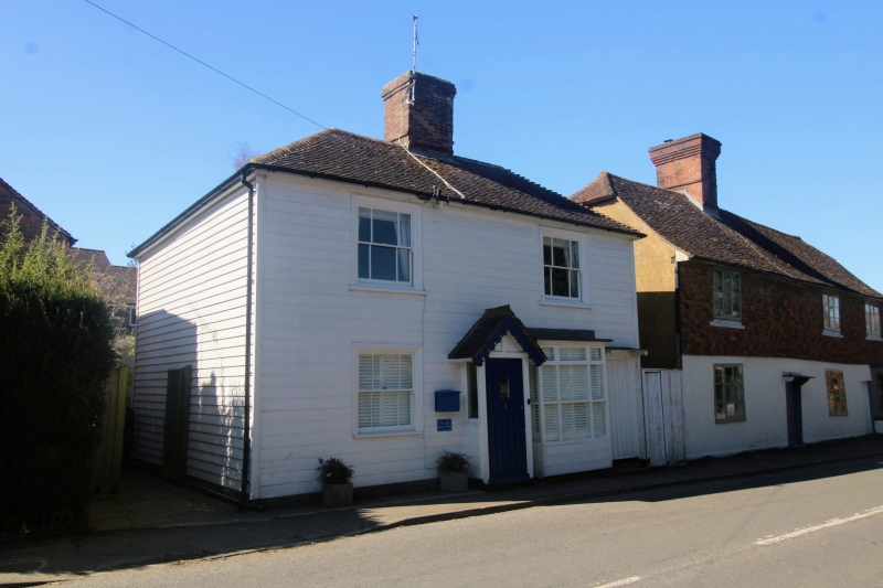
Entry Name: The Sweet Shop
Listing Date: 5 July 1993
Grade: II
Source: Historic England
Source ID: 1204485
English Heritage Legacy ID: 170249
ID on this website: 101204485
Location: Benenden, Tunbridge Wells, Kent, TN17
County: Kent
District: Tunbridge Wells
Civil Parish: Benenden
Built-Up Area: Benenden
Traditional County: Kent
Lieutenancy Area (Ceremonial County): Kent
Tagged with: Architectural structure
BENENDEN
TQ8032 THE STREET
1350-0/7/144 (South West side)
The Sweet Shop
GV II
House and shop. c.1830 altered late C19. Wood, grooved to
imitate masonry and hipped tiled roof. 2 storeys, 2 windows.
Mid C19 sashes with 6 panes, horns and moulded architraves.
Central projecting gabled porch with carved bargeboards. Right
hand later C19 projecting shopfront.
Listing NGR: TQ8082332929
External links are from the relevant listing authority and, where applicable, Wikidata. Wikidata IDs may be related buildings as well as this specific building. If you want to add or update a link, you will need to do so by editing the Wikidata entry.


Other nearby listed buildings
