Approximate Location Map
Large Map »
Latitude: 51.2801 / 51°16'48"N
Longitude: 1.0795 / 1°4'46"E
OS Eastings: 614861
OS Northings: 157946
OS Grid: TR148579
Mapcode National: GBR TY2.PQH
Mapcode Global: VHLGM.N2JZ
Plus Code: 9F3373JH+2Q
Entry Name: 16A, Best Lane
Listing Date: 3 May 1967
Grade: II
Source: Historic England
Source ID: 1336776
English Heritage Legacy ID: 170385
ID on this website: 101336776
Location: Canterbury, Kent, CT1
County: Kent
District: Canterbury
Electoral Ward/Division: Westgate
Parish: Non Civil Parish
Built-Up Area: Canterbury
Traditional County: Kent
Lieutenancy Area (Ceremonial County): Kent
Tagged with: Building
1.
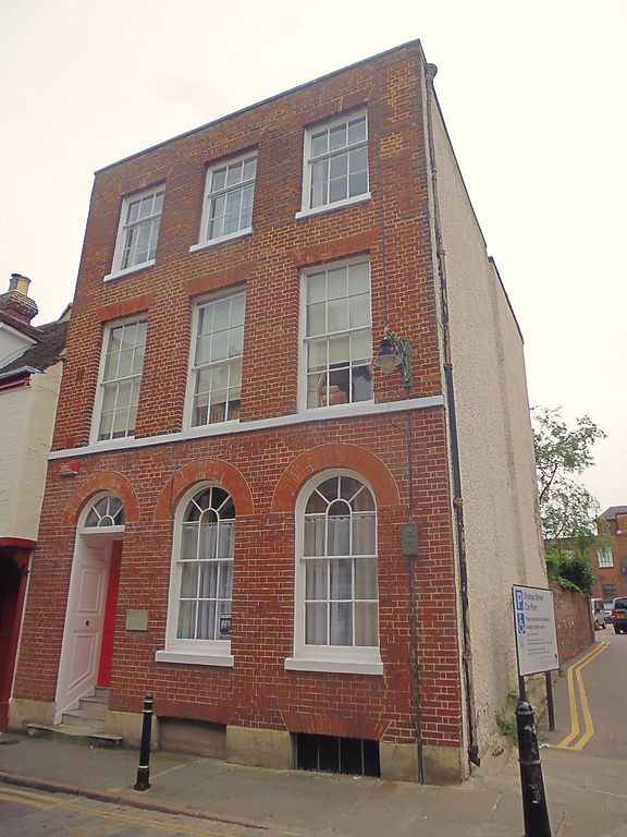
944 BEST LANE
(South East Side)
No 16A
TR 1457 NE 4/90 3.5.67.
II GV
2.
C18. 3 storeys red brick. Ground floor now painted. Stone coping. Stringcourse.
3 sashes with glazing bars intact. Round-headed sashes on ground floor.
Left side doorcase has semi-circular fanlights, panelled reveals and 6 fielded
panelled door. 4 stone steps.
Nos 16A to 20 (consec), Nos 22 and 23 form a group.
Listing NGR: TR1486357943
External links are from the relevant listing authority and, where applicable, Wikidata. Wikidata IDs may be related buildings as well as this specific building. If you want to add or update a link, you will need to do so by editing the Wikidata entry.


Other nearby listed buildings
