Approximate Location Map
Large Map »
Latitude: 51.2785 / 51°16'42"N
Longitude: 1.0854 / 1°5'7"E
OS Eastings: 615284
OS Northings: 157785
OS Grid: TR152577
Mapcode National: GBR TY2.Z2L
Mapcode Global: VHLGM.R4P7
Plus Code: 9F3373HP+C5
Entry Name: Cromwell House
Listing Date: 7 September 1973
Grade: II
Source: Historic England
Source ID: 1085141
English Heritage Legacy ID: 170410
ID on this website: 101085141
Location: Canterbury, Kent, CT1
County: Kent
District: Canterbury
Electoral Ward/Division: Barton
Parish: Non Civil Parish
Built-Up Area: Canterbury
Traditional County: Kent
Lieutenancy Area (Ceremonial County): Kent
Tagged with: House
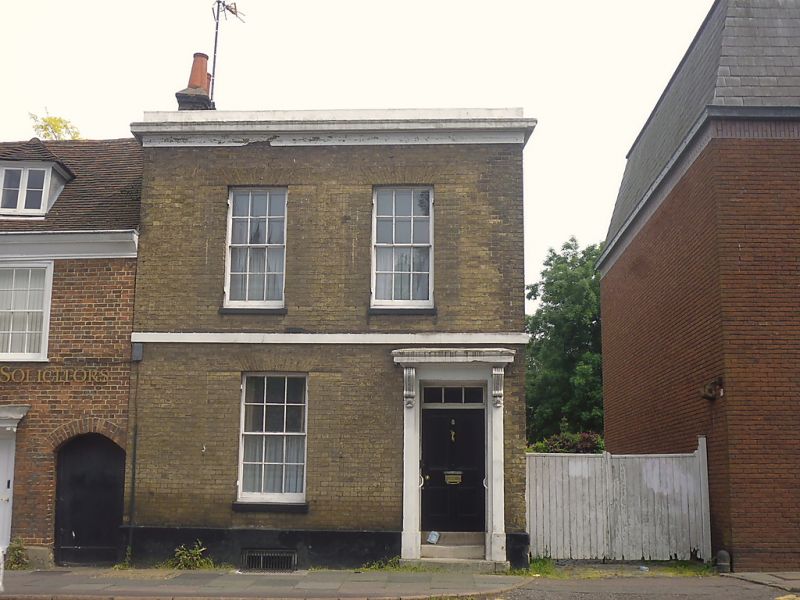
1.
944 BROAD STREET
(North East Side)
No 8
TR 1557 NW 5/737 (Cromwell House)
II .
2.
Early C19. 2 storeys and basement buff brick. Moulded stone cornice. 2
sashes with glazing bars intact. Stringcourse. Right side doorcase with
cornice and 2 scroll brackets, rectangular fanlight and 4 panelled door.
2 steps.
Listing NGR: TR1528657784
External links are from the relevant listing authority and, where applicable, Wikidata. Wikidata IDs may be related buildings as well as this specific building. If you want to add or update a link, you will need to do so by editing the Wikidata entry.


Other nearby listed buildings
