Approximate Location Map
Large Map »
Latitude: 51.2801 / 51°16'48"N
Longitude: 1.0862 / 1°5'10"E
OS Eastings: 615328
OS Northings: 157959
OS Grid: TR153579
Mapcode National: GBR TY2.RDN
Mapcode Global: VHLGM.S321
Plus Code: 9F3373JP+2F
Entry Name: 34-36, Broad Street
Listing Date: 7 September 1973
Grade: II
Source: Historic England
Source ID: 1336782
English Heritage Legacy ID: 170413
ID on this website: 101336782
Location: Northgate, Canterbury, Kent, CT1
County: Kent
District: Canterbury
Electoral Ward/Division: Barton
Parish: Non Civil Parish
Built-Up Area: Canterbury
Traditional County: Kent
Lieutenancy Area (Ceremonial County): Kent
Tagged with: Building
1.
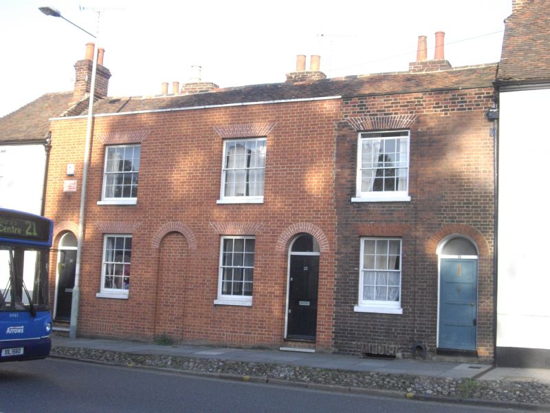
944 BROAD STREET
(North East Side)
TR 1557 NW 5/427 34 to 36 (consec)
II GV
2.
Late C18. 2 storeys red brick. No 35 and 36 are now stuccoed. Tiled roof.
1 sash with verticals only to each, No 34 has a round- headed. doorcase.
The rest have altered shopfronts. Grade II for group value.
Nos 33 to 44 (consec) and No 46 form a group.
Listing NGR: TR1533457957
External links are from the relevant listing authority and, where applicable, Wikidata. Wikidata IDs may be related buildings as well as this specific building. If you want to add or update a link, you will need to do so by editing the Wikidata entry.


Other nearby listed buildings
