Approximate Location Map
Large Map »
Latitude: 51.2823 / 51°16'56"N
Longitude: 1.0838 / 1°5'1"E
OS Eastings: 615154
OS Northings: 158197
OS Grid: TR151581
Mapcode National: GBR TY2.JV3
Mapcode Global: VHLGM.Q1TB
Plus Code: 9F3373JM+WG
Entry Name: 77, Broad Street
Listing Date: 7 September 1973
Grade: II
Source: Historic England
Source ID: 1085149
English Heritage Legacy ID: 170431
ID on this website: 101085149
Location: Northgate, Canterbury, Kent, CT1
County: Kent
District: Canterbury
Electoral Ward/Division: Northgate
Parish: Non Civil Parish
Built-Up Area: Canterbury
Traditional County: Kent
Lieutenancy Area (Ceremonial County): Kent
Tagged with: Building
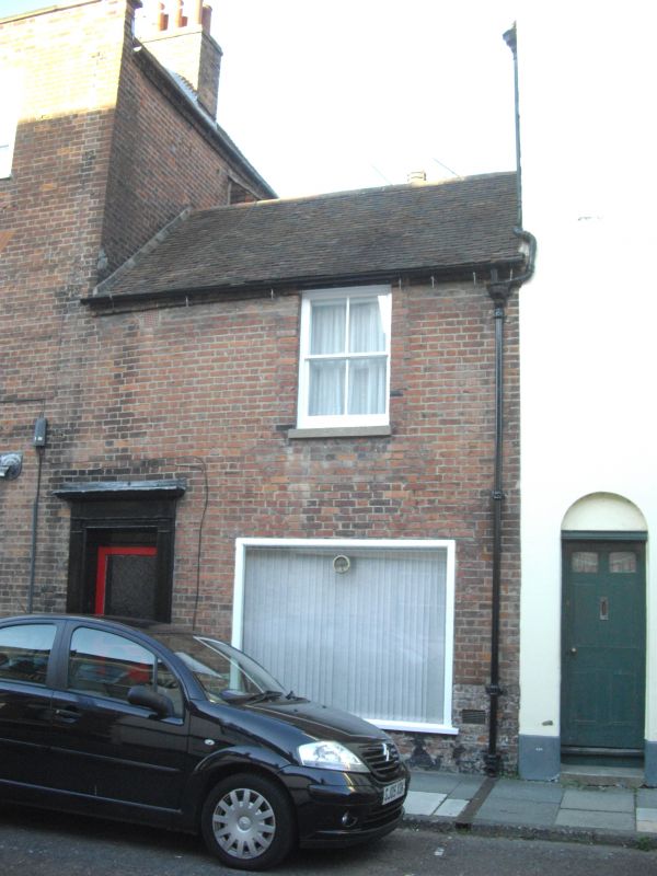
1.
944 BROAD STREET
(North East Side)
No 77
TR 1558 SW 3/438
II GV
2.
An early C19 extension to Nos 78 and 79. 2 storeys red brick. Toed roof.
1 sash with verticals only. C19 shopfront. Left side doorcase with cornice
plain pilasters and panelled door.
Nos 66 to 79 (consec) form a group.
Listing NGR: TR1515458197
External links are from the relevant listing authority and, where applicable, Wikidata. Wikidata IDs may be related buildings as well as this specific building. If you want to add or update a link, you will need to do so by editing the Wikidata entry.


Other nearby listed buildings
