Approximate Location Map
Large Map »
Latitude: 51.2821 / 51°16'55"N
Longitude: 1.0836 / 1°5'0"E
OS Eastings: 615139
OS Northings: 158183
OS Grid: TR151581
Mapcode National: GBR TY2.JRZ
Mapcode Global: VHLGM.Q1QF
Plus Code: 9F3373JM+VC
Entry Name: 80, Broad Street
Listing Date: 3 May 1967
Grade: II
Source: Historic England
Source ID: 1085104
English Heritage Legacy ID: 170433
ID on this website: 101085104
Location: Northgate, Canterbury, Kent, CT1
County: Kent
District: Canterbury
Electoral Ward/Division: Westgate
Parish: Non Civil Parish
Built-Up Area: Canterbury
Traditional County: Kent
Lieutenancy Area (Ceremonial County): Kent
Tagged with: Building
1.
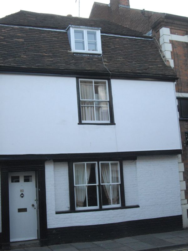
944 BROAD STREET
(South West Side)
No 80
TR 1558 SW 3/58 3.5.67.
II GV
2.
C16 or early C17 timber-framed building refaced in C18. 2 storeys plastered.
Tiled mansard roof with 1 dormer. 1 sash with verticals only on first floor.
Bressumer. Double hung curved sash on ground floor. Left side doorcase
in moulded wooden architrave with cornice and pilasters. 6 panelled door.
Nos 80 to 89 (consec) form a group.
Listing NGR: TR1513958183
External links are from the relevant listing authority and, where applicable, Wikidata. Wikidata IDs may be related buildings as well as this specific building. If you want to add or update a link, you will need to do so by editing the Wikidata entry.


Other nearby listed buildings
