Approximate Location Map
Large Map »
Latitude: 51.2782 / 51°16'41"N
Longitude: 1.084 / 1°5'2"E
OS Eastings: 615183
OS Northings: 157743
OS Grid: TR151577
Mapcode National: GBR TY2.YNS
Mapcode Global: VHLGM.Q4XH
Plus Code: 9F3373HM+7H
Entry Name: 63 and 64, Burgate
Listing Date: 3 May 1967
Grade: II
Source: Historic England
Source ID: 1262520
English Heritage Legacy ID: 170472
ID on this website: 101262520
Location: Canterbury, Kent, CT1
County: Kent
District: Canterbury
Electoral Ward/Division: Westgate
Parish: Non Civil Parish
Built-Up Area: Canterbury
Traditional County: Kent
Lieutenancy Area (Ceremonial County): Kent
Tagged with: Building
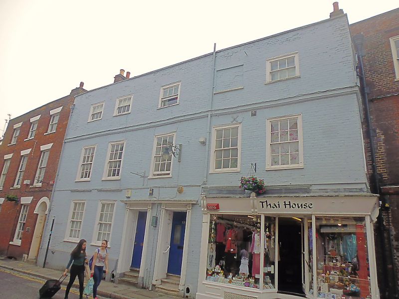
1.
944 BURGATE
(South West Side)
Nos 63 and 64
TR 1557 NW 5/32 3.5.67.
II GV
2.
Early C19. 3 storeys painted brick. Hipped old tiled roof. Stone coping.
5 Bashes in moulded architraves with glazing bad intact. Stringcourse.
1 blank on second floor. Plinth. Double doorcase with paterae, panelled
reveals and 6 fielded panelled doors. 3 steps. No 63 has mid C19 shopfront.
Nos 62 to 69 (consec) form a group with No 1 Burgate Lane.
Listing NGR: TR1517857731
External links are from the relevant listing authority and, where applicable, Wikidata. Wikidata IDs may be related buildings as well as this specific building. If you want to add or update a link, you will need to do so by editing the Wikidata entry.


Other nearby listed buildings
