Approximate Location Map
Large Map »
Latitude: 51.2781 / 51°16'41"N
Longitude: 1.0843 / 1°5'3"E
OS Eastings: 615210
OS Northings: 157735
OS Grid: TR152577
Mapcode National: GBR TY2.YSP
Mapcode Global: VHLGM.R43K
Plus Code: 9F3373HM+6P
Entry Name: 69, Burgate
Listing Date: 3 May 1967
Grade: II
Source: Historic England
Source ID: 1085125
English Heritage Legacy ID: 170476
ID on this website: 101085125
Location: Canterbury, Kent, CT1
County: Kent
District: Canterbury
Electoral Ward/Division: Westgate
Parish: Non Civil Parish
Built-Up Area: Canterbury
Traditional County: Kent
Lieutenancy Area (Ceremonial County): Kent
Tagged with: Building
1.
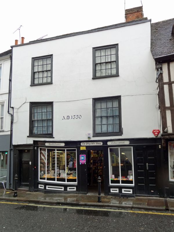
944 BURGATE
(South West Side)
No 69
TR 1557 NW 5/35 3.5.67.
II GV
2.
Early C16 building refronted in C18. 3 storeys stuccoed, Hipped tiled roof.
5 C19 sashes with moulded wooden architraves. Overhang, Modern shop front.
Nos 62 to 69 (consec) form a group with No 1 Burgate Lane.
Listing NGR: TR1520857733
External links are from the relevant listing authority and, where applicable, Wikidata. Wikidata IDs may be related buildings as well as this specific building. If you want to add or update a link, you will need to do so by editing the Wikidata entry.


Other nearby listed buildings
