Approximate Location Map
Large Map »
Latitude: 51.2787 / 51°16'43"N
Longitude: 1.0814 / 1°4'53"E
OS Eastings: 615002
OS Northings: 157795
OS Grid: TR150577
Mapcode National: GBR TY2.Q7M
Mapcode Global: VHLGM.P4K2
Plus Code: 9F3373HJ+FH
Entry Name: 6, Butchery Lane
Listing Date: 3 May 1967
Grade: II
Source: Historic England
Source ID: 1085085
English Heritage Legacy ID: 170484
ID on this website: 101085085
Location: Canterbury, Kent, CT1
County: Kent
District: Canterbury
Electoral Ward/Division: Westgate
Parish: Non Civil Parish
Built-Up Area: Canterbury
Traditional County: Kent
Lieutenancy Area (Ceremonial County): Kent
Tagged with: Building
1.
944 BUTCHERY LANE
No 6
TR 1557 NW 5/450 3.5.67.
II GV
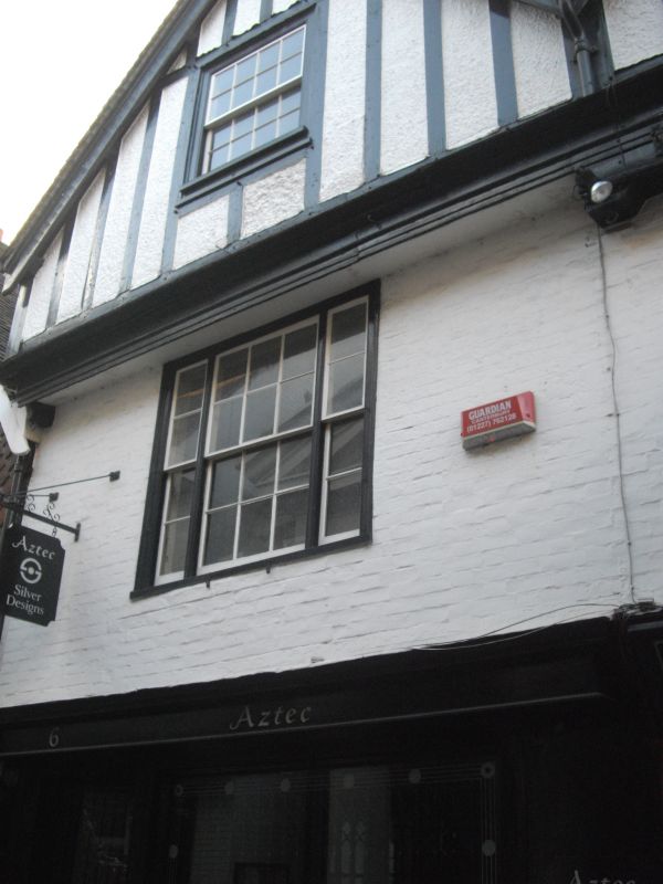
2.
Mediaeval and later, 2 storeys painted brick. Victorian gable front added.
1 sash with glazing bars intact. 3-light on the first floor. Later shopfront
C18 staircase with scrolled tread ends and panelling.
Nos 1 to 9 (consec) and Nos 38 to 44 (consec) Burgate together
with Nos 1 to 8A (consec) and Nos 10 top 16 Mercery Lane form a group.
Listing NGR: TR1500157797
External links are from the relevant listing authority and, where applicable, Wikidata. Wikidata IDs may be related buildings as well as this specific building. If you want to add or update a link, you will need to do so by editing the Wikidata entry.


Other nearby listed buildings
