Approximate Location Map
Large Map »
Latitude: 51.2787 / 51°16'43"N
Longitude: 1.0814 / 1°4'52"E
OS Eastings: 614999
OS Northings: 157791
OS Grid: TR149577
Mapcode National: GBR TY2.Q6K
Mapcode Global: VHLGM.P4J3
Plus Code: 9F3373HJ+FG
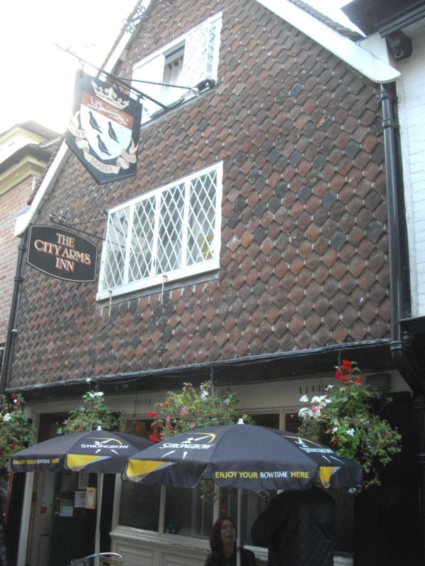
Entry Name: City Arms
Listing Date: 3 May 1967
Grade: II
Source: Historic England
Source ID: 1336797
English Heritage Legacy ID: 170485
Also known as: The City Arms, Canterbury
ID on this website: 101336797
Location: Canterbury, Kent, CT1
County: Kent
District: Canterbury
Electoral Ward/Division: Westgate
Parish: Non Civil Parish
Built-Up Area: Canterbury
Traditional County: Kent
Lieutenancy Area (Ceremonial County): Kent
Tagged with: Pub
1.
944 BUTCHERY LANE
No 7
(City Arms)
TR 1557 NW 5/451
TR 1457 NE 4/451 3.5.67
II GV
2.
Mediaeval and later. 2 storeys and gable. Modern tile-hung. Old tiled roof.
Restored mullions with leaded lights. C19 shopfront.
Nos 1 to 9 (consec) and Nos 38 to 44 (consec) Burgate together
with Nos 1 to 8A (consewc) and Nos 10 to 16 Mercery Lane form a group.
Listing NGR: TR1499157796
External links are from the relevant listing authority and, where applicable, Wikidata. Wikidata IDs may be related buildings as well as this specific building. If you want to add or update a link, you will need to do so by editing the Wikidata entry.


Other nearby listed buildings
