Approximate Location Map
Large Map »
Latitude: 51.2771 / 51°16'37"N
Longitude: 1.0775 / 1°4'39"E
OS Eastings: 614740
OS Northings: 157607
OS Grid: TR147576
Mapcode National: GBR TY2.WT1
Mapcode Global: VHLGM.M5H9
Plus Code: 9F3373GH+R2
Entry Name: 6 and 7, Castle Street
Listing Date: 3 May 1967
Grade: II
Source: Historic England
Source ID: 1085091
English Heritage Legacy ID: 170493
ID on this website: 101085091
Location: Canterbury, Kent, CT1
County: Kent
District: Canterbury
Electoral Ward/Division: Westgate
Parish: Non Civil Parish
Built-Up Area: Canterbury
Traditional County: Kent
Lieutenancy Area (Ceremonial County): Kent
Tagged with: Building
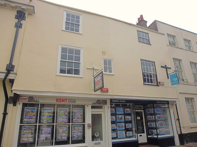
1. CASTLE STREET
(South East Side)
Nos 6 and 7
TR 1457 NE 4/206 3.5.67.
II GV
2.
2 small timber-framed houses refronted in the C18. 3 storeys stuccoed. Stone
coping. First floor preserves overhang. 2 sashes in moulded architraves
with glazing bars intact. later shopfronts. Rear elevation has 2 gable
ends.
Nos 1 to 9 (consec) and Nos 12 to 24 (consec) form a group.
Listing NGR: TR1474657603
External links are from the relevant listing authority and, where applicable, Wikidata. Wikidata IDs may be related buildings as well as this specific building. If you want to add or update a link, you will need to do so by editing the Wikidata entry.


Other nearby listed buildings
