Approximate Location Map
Large Map »
Latitude: 51.2766 / 51°16'35"N
Longitude: 1.0763 / 1°4'34"E
OS Eastings: 614653
OS Northings: 157544
OS Grid: TR146575
Mapcode National: GBR TY2.WFM
Mapcode Global: VHLGM.L5TP
Plus Code: 9F3373GG+JG
Entry Name: 53-55, Castle Street
Listing Date: 3 May 1967
Grade: II
Source: Historic England
Source ID: 1085099
English Heritage Legacy ID: 170513
ID on this website: 101085099
Location: Canterbury, Kent, CT1
County: Kent
District: Canterbury
Electoral Ward/Division: Westgate
Parish: Non Civil Parish
Built-Up Area: Canterbury
Traditional County: Kent
Lieutenancy Area (Ceremonial County): Kent
Tagged with: Building
1.
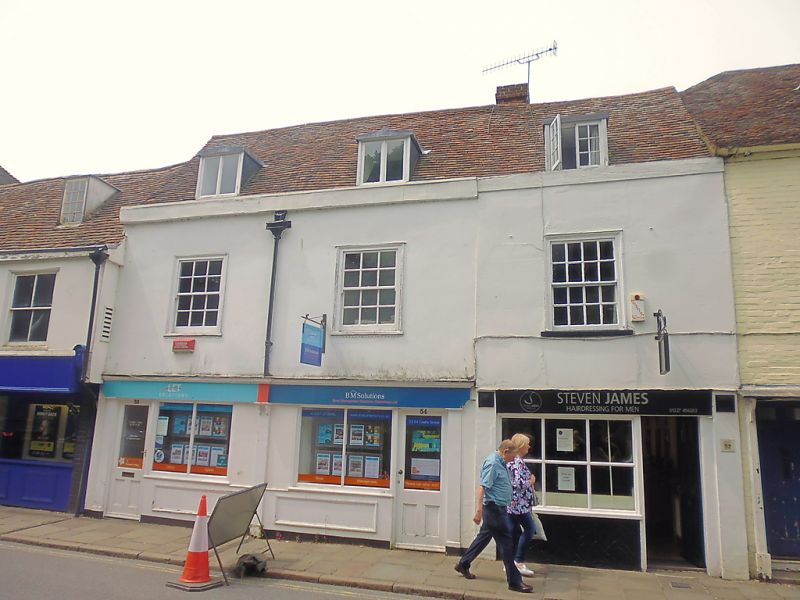
944 CASTLE STREET
(North West Side)
Nos 53 to 55 (consec)
TR 1457 NE 4/263 3.5.67.
II GV
2.
Early C18 pair. 2 storeys stuccoed. Old tiled roof with 3 dormers. 3 sashes
with glazing bars intact. Later shopfronts.
Nos 49 to 67 (consec) form a group.
Listing NGR: TR1464857542
External links are from the relevant listing authority and, where applicable, Wikidata. Wikidata IDs may be related buildings as well as this specific building. If you want to add or update a link, you will need to do so by editing the Wikidata entry.


Other nearby listed buildings
