Approximate Location Map
Large Map »
Latitude: 51.277 / 51°16'37"N
Longitude: 1.0768 / 1°4'36"E
OS Eastings: 614692
OS Northings: 157590
OS Grid: TR146575
Mapcode National: GBR TY2.WLM
Mapcode Global: VHLGM.M54D
Plus Code: 9F3373GG+QP
Entry Name: 67, Castle Street
Listing Date: 7 September 1973
Grade: II
Source: Historic England
Source ID: 1336803
English Heritage Legacy ID: 170518
ID on this website: 101336803
Location: Canterbury, Kent, CT1
County: Kent
District: Canterbury
Electoral Ward/Division: Westgate
Parish: Non Civil Parish
Built-Up Area: Canterbury
Traditional County: Kent
Lieutenancy Area (Ceremonial County): Kent
Tagged with: Building
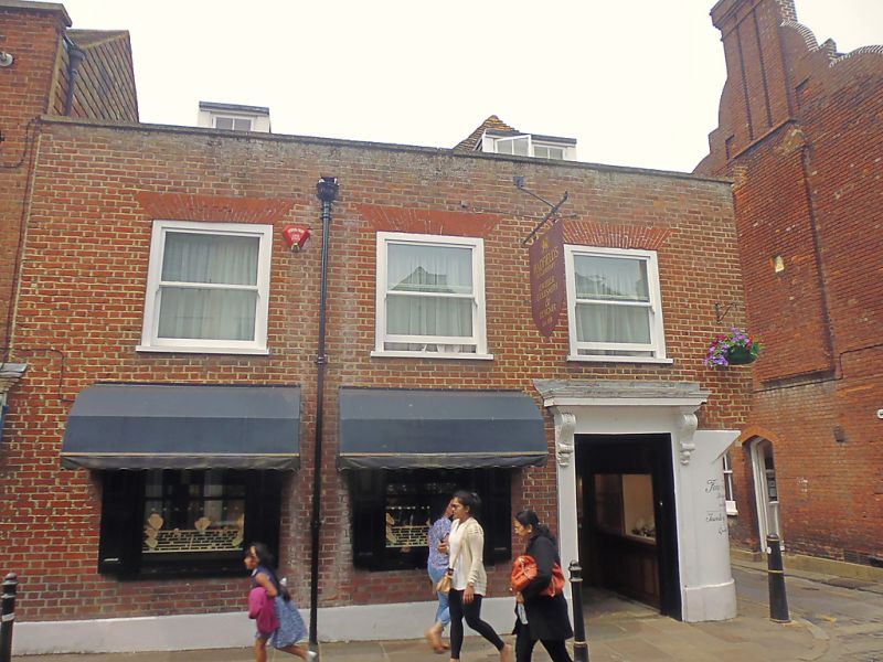
1.
944 CASTLE STREET
(North West Side)
No 67
TR 1457 NE 4/211
II GV
2.
An early C16 L-shaped building refaced in C18. 2 storeys red brick. 2 dormers,
3 C19 sashes. Stone coping. Side elevation has an overhang and hipped roof.
Doorcase with heavy cornice supported by voluted consoles.
Nos 49 to 67 (consec) form a group.
Listing NGR: TR1468857592
External links are from the relevant listing authority and, where applicable, Wikidata. Wikidata IDs may be related buildings as well as this specific building. If you want to add or update a link, you will need to do so by editing the Wikidata entry.


Other nearby listed buildings
