Approximate Location Map
Large Map »
Latitude: 51.2756 / 51°16'32"N
Longitude: 1.0778 / 1°4'39"E
OS Eastings: 614763
OS Northings: 157441
OS Grid: TR147574
Mapcode National: GBR TY2.WVV
Mapcode Global: VHLGM.M6MG
Plus Code: 9F3373GH+64
Entry Name: Sundial
Listing Date: 7 September 1973
Grade: II
Source: Historic England
Source ID: 1085045
English Heritage Legacy ID: 170586
ID on this website: 101085045
Location: Dane John Gardens, Canterbury, Kent, CT1
County: Kent
District: Canterbury
Electoral Ward/Division: Westgate
Parish: Non Civil Parish
Built-Up Area: Canterbury
Traditional County: Kent
Lieutenancy Area (Ceremonial County): Kent
Tagged with: Sundial
1.
944 DANE JOHN
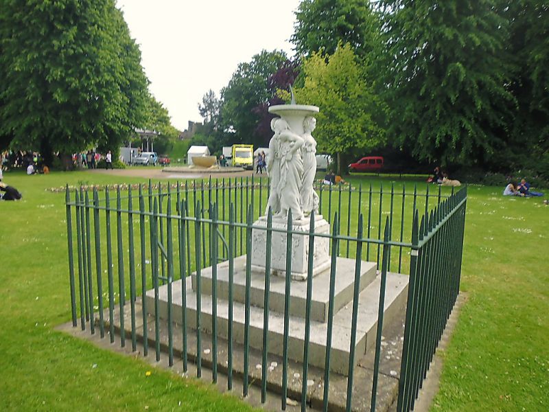
Sundial
TR 1457 SE 8/480
II
2.
Sundial set on plinth with 3 marble figures. 3 steps to base.
Listing NGR: TR1476257441
External links are from the relevant listing authority and, where applicable, Wikidata. Wikidata IDs may be related buildings as well as this specific building. If you want to add or update a link, you will need to do so by editing the Wikidata entry.


Other nearby listed buildings
