Approximate Location Map
Large Map »
Latitude: 51.2807 / 51°16'50"N
Longitude: 1.0787 / 1°4'43"E
OS Eastings: 614801
OS Northings: 158008
OS Grid: TR148580
Mapcode National: GBR TY2.PHP
Mapcode Global: VHLGM.N23K
Plus Code: 9F3373JH+7F
Entry Name: 13, the Friars
Listing Date: 7 September 1973
Grade: II
Source: Historic England
Source ID: 1085059
English Heritage Legacy ID: 170616
ID on this website: 101085059
Location: Canterbury, Kent, CT1
County: Kent
District: Canterbury
Electoral Ward/Division: Westgate
Parish: Non Civil Parish
Built-Up Area: Canterbury
Traditional County: Kent
Lieutenancy Area (Ceremonial County): Kent
Tagged with: Building
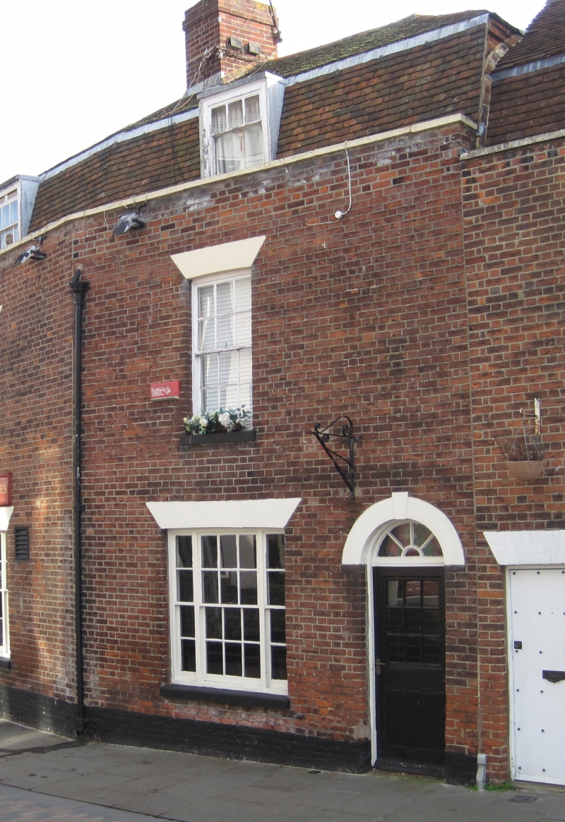
1.
944
TR 1458 SE
2/87
THE FRIARS
No 13
II
GV
2.
Late C18. 2 storeys red brick. Tiled mansard roof having 1 dormer with
sash window. 1 sash window with glazing bars intact, 3 light on ground floor.
Right side round-headed doorcase with keystones and fanlight. Rainwater
head. Joined to No 12.
Nos 11 to 18 (consec) form a group.
Listing NGR: TR1480158007
External links are from the relevant listing authority and, where applicable, Wikidata. Wikidata IDs may be related buildings as well as this specific building. If you want to add or update a link, you will need to do so by editing the Wikidata entry.


Other nearby listed buildings
