Approximate Location Map
Large Map »
Latitude: 51.2799 / 51°16'47"N
Longitude: 1.0805 / 1°4'49"E
OS Eastings: 614932
OS Northings: 157930
OS Grid: TR149579
Mapcode National: GBR TY2.PZ7
Mapcode Global: VHLGM.P323
Plus Code: 9F3373HJ+X5
Entry Name: 1 AND 1A, GUILDHALL STREET (See details for further address information)
Listing Date: 7 September 1973
Grade: II
Source: Historic England
Source ID: 1240639
English Heritage Legacy ID: 170622
ID on this website: 101240639
Location: Canterbury, Kent, CT1
County: Kent
District: Canterbury
Electoral Ward/Division: Westgate
Parish: Non Civil Parish
Built-Up Area: Canterbury
Traditional County: Kent
Lieutenancy Area (Ceremonial County): Kent
Tagged with: Building
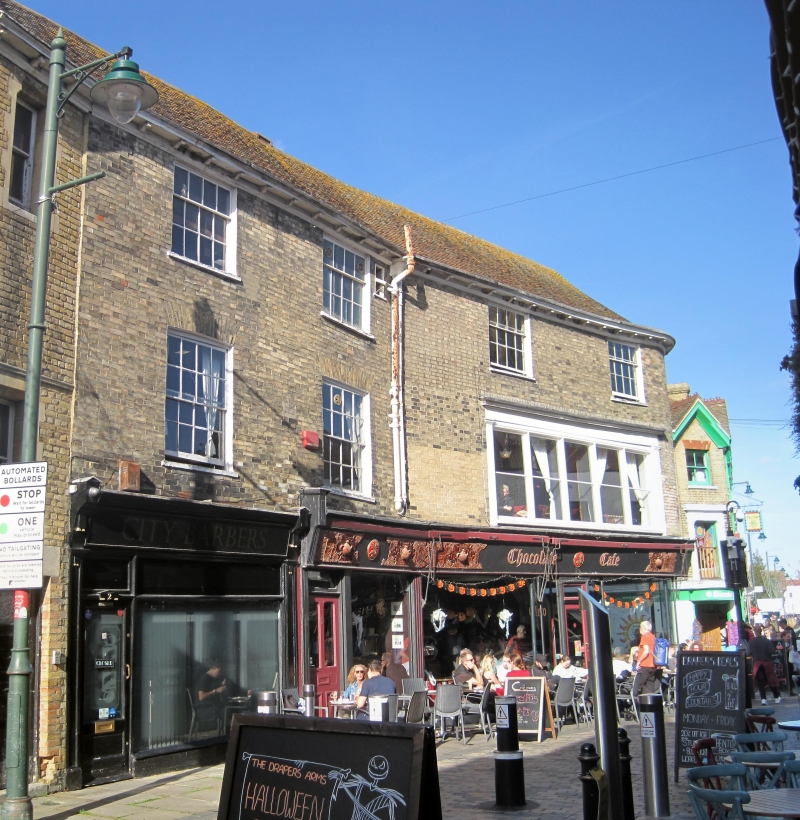
1.
944 GUILDHALL STREET
Nos 1 & lA
No 2
TR 1457 NE 4/274
II GV
2.
Late C18 or early C19. 3 storeys buff brick. Tiled roof with bracket eaves
cornice, 4 sashes with glazing bars intact, 1st floor has a 3 light bay,
Ground floor has early C19 shopfronts. Rounded corner to Orange Street.
Nos 1 to 10 (consec) form a group.
Listing NGR: TR1492757925
External links are from the relevant listing authority and, where applicable, Wikidata. Wikidata IDs may be related buildings as well as this specific building. If you want to add or update a link, you will need to do so by editing the Wikidata entry.


Other nearby listed buildings
