Approximate Location Map
Large Map »
Latitude: 51.2785 / 51°16'42"N
Longitude: 1.0786 / 1°4'43"E
OS Eastings: 614810
OS Northings: 157760
OS Grid: TR148577
Mapcode National: GBR TY2.X2M
Mapcode Global: VHLGM.N428
Plus Code: 9F3373HH+9F
Entry Name: Arnett House
Listing Date: 7 September 1973
Grade: II
Source: Historic England
Source ID: 1085023
English Heritage Legacy ID: 170637
ID on this website: 101085023
Location: Canterbury, Kent, CT1
County: Kent
District: Canterbury
Electoral Ward/Division: Westgate
Parish: Non Civil Parish
Built-Up Area: Canterbury
Traditional County: Kent
Lieutenancy Area (Ceremonial County): Kent
Tagged with: House
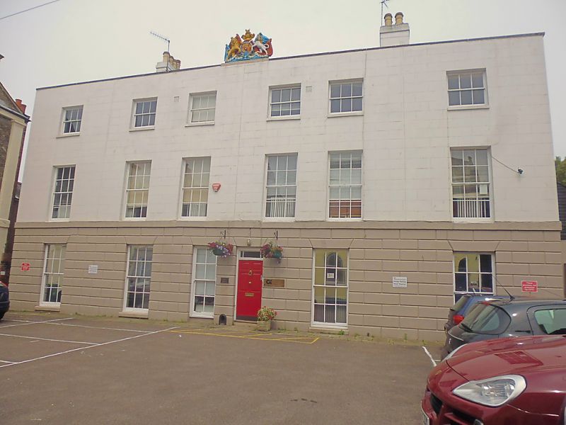
1.
944 HAWKS LANE
(North East Side)
No 22 (Arnett House)
TR 1457 BE 4/354
II
2.
Originally 3 houses. Early C19. 3 storeys faced with cement, the ground
floor rusticated. Parapet and stringcourses, Cartouche of the Royal Arms
above the centre. 6 sashes with glazing bars intact.
Listing NGR: TR1481857759
External links are from the relevant listing authority and, where applicable, Wikidata. Wikidata IDs may be related buildings as well as this specific building. If you want to add or update a link, you will need to do so by editing the Wikidata entry.


Other nearby listed buildings
