Approximate Location Map
Large Map »
Latitude: 51.3608 / 51°21'39"N
Longitude: 1.0261 / 1°1'33"E
OS Eastings: 610769
OS Northings: 166766
OS Grid: TR107667
Mapcode National: GBR TX1.N7X
Mapcode Global: VHKJR.Q2T3
Plus Code: 9F33926G+8C
Entry Name: 25, Albert Street
Listing Date: 20 May 1977
Grade: II
Source: Historic England
Source ID: 1087046
English Heritage Legacy ID: 170778
ID on this website: 101087046
Location: Whitstable, Canterbury, Kent, CT5
County: Kent
District: Canterbury
Electoral Ward/Division: Gorrell
Parish: Non Civil Parish
Built-Up Area: Whitstable
Traditional County: Kent
Lieutenancy Area (Ceremonial County): Kent
Tagged with: Building
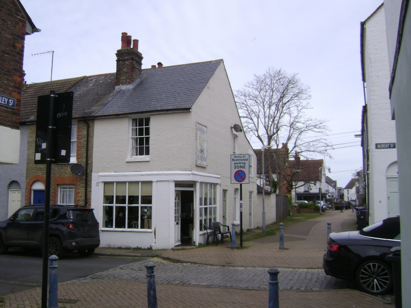
ALBERT STREET
1.
5273
(Worth Side)
No 25
TR 1066 NE 1/62
II
2.
At corner of Albert Street and Bexley Street. 1st half of C19, yellow brick with
red brick quoins, 2 storey, slate roof with shop under having original glazing
bare complete, pilasters, fascia and cornice. Door across angle with glazing bars
and bead flush panels under. Glazing bard complete in box sashes 1st floor.
Listing NGR: TR1076966766
External links are from the relevant listing authority and, where applicable, Wikidata. Wikidata IDs may be related buildings as well as this specific building. If you want to add or update a link, you will need to do so by editing the Wikidata entry.


Other nearby listed buildings
