Approximate Location Map
Large Map »
Latitude: 51.3505 / 51°21'1"N
Longitude: 1.0213 / 1°1'16"E
OS Eastings: 610485
OS Northings: 165597
OS Grid: TR104655
Mapcode National: GBR TX7.71K
Mapcode Global: VHKJR.NB92
Plus Code: 9F33922C+5G
Entry Name: Waypost House
Listing Date: 20 May 1977
Grade: II
Source: Historic England
Source ID: 1086997
English Heritage Legacy ID: 170789
ID on this website: 101086997
Location: Lower Island, Canterbury, Kent, CT5
County: Kent
District: Canterbury
Electoral Ward/Division: Gorrell
Parish: Non Civil Parish
Built-Up Area: Whitstable
Traditional County: Kent
Lieutenancy Area (Ceremonial County): Kent
Tagged with: House
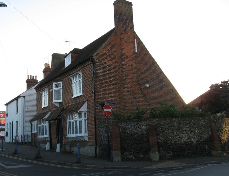
BORSTAL HILL
1.
5273
(West Side)
No 4
(Waypost House)
TR 16 NW 4/24
II GV
2.
Early C18 2 storey building with attic and tiled roof. 3 windows 1st floor. 1
hipped dormer. Red brick. Modillion eaves course consisting of 3 courses of bricks,
the centre course inserted diagonally. All modern windows. T iled roof over modern
extension to the south of single storey.
Listing NGR: TR1048565597
External links are from the relevant listing authority and, where applicable, Wikidata. Wikidata IDs may be related buildings as well as this specific building. If you want to add or update a link, you will need to do so by editing the Wikidata entry.


Other nearby listed buildings
