Approximate Location Map
Large Map »
Latitude: 51.3603 / 51°21'37"N
Longitude: 1.0244 / 1°1'27"E
OS Eastings: 610651
OS Northings: 166706
OS Grid: TR106667
Mapcode National: GBR TX1.MSJ
Mapcode Global: VHKJR.P2XH
Plus Code: 9F33926F+4P
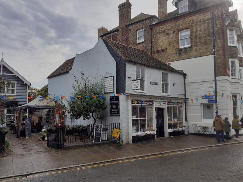
Entry Name: 33, Harbour Street
Listing Date: 20 May 1977
Grade: II
Source: Historic England
Source ID: 1106373
English Heritage Legacy ID: 170829
ID on this website: 101106373
Location: Whitstable, Canterbury, Kent, CT5
County: Kent
District: Canterbury
Electoral Ward/Division: Gorrell
Parish: Non Civil Parish
Built-Up Area: Whitstable
Traditional County: Kent
Lieutenancy Area (Ceremonial County): Kent
Tagged with: Building
1.
5275
TR 1066 NE
1/101
HARBOUR STREET
(South-East Side)
No 55
II
2.
Early C19 2 storey building of brick with plain tile roof. 2 sashes 1st floor
with glazing bars missing. Early C19 shop front with original glazing bars and
door.
Listing NGR: TR1065166706
External links are from the relevant listing authority and, where applicable, Wikidata. Wikidata IDs may be related buildings as well as this specific building. If you want to add or update a link, you will need to do so by editing the Wikidata entry.


Other nearby listed buildings
