Approximate Location Map
Large Map »
Latitude: 51.3601 / 51°21'36"N
Longitude: 1.024 / 1°1'26"E
OS Eastings: 610626
OS Northings: 166677
OS Grid: TR106666
Mapcode National: GBR TX1.MQF
Mapcode Global: VHKJR.P2PP
Plus Code: 9F33926F+2H
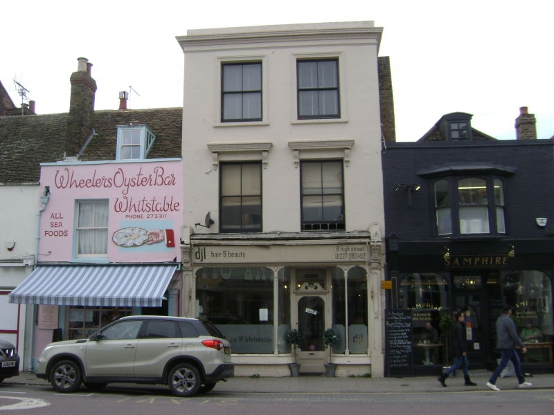
Entry Name: 6, High Street
Listing Date: 20 May 1977
Grade: II
Source: Historic England
Source ID: 1325939
English Heritage Legacy ID: 170834
ID on this website: 101325939
Location: Whitstable, Canterbury, Kent, CT5
County: Kent
District: Canterbury
Electoral Ward/Division: Gorrell
Parish: Non Civil Parish
Built-Up Area: Whitstable
Traditional County: Kent
Lieutenancy Area (Ceremonial County): Kent
Tagged with: Building
1.
5273
TR 1066 NE
1/115
HIGH STREET
(West Side)
No 6
II
2.
Mid C19. Brick built with 3 storeys, having a rendered facade with parapet and
slate roof. 2 w indowa 1st floor and 2nd floor with moulded architrave around
and cornice on brackets over 1st floor windows and glazing intact. Late C19 shop
front.
Listing NGR: TR1062666677
External links are from the relevant listing authority and, where applicable, Wikidata. Wikidata IDs may be related buildings as well as this specific building. If you want to add or update a link, you will need to do so by editing the Wikidata entry.


Other nearby listed buildings
