Approximate Location Map
Large Map »
Latitude: 51.3588 / 51°21'31"N
Longitude: 1.0202 / 1°1'12"E
OS Eastings: 610370
OS Northings: 166525
OS Grid: TR103665
Mapcode National: GBR TX1.LRZ
Mapcode Global: VHKJR.M3QN
Plus Code: 9F33925C+G3
Entry Name: The Old Neptune Public House
Listing Date: 20 May 1977
Grade: II
Source: Historic England
Source ID: 1084945
English Heritage Legacy ID: 170843
Also known as: Old Neptune, Whitstable
Old Neptune
ID on this website: 101084945
Location: Lower Island, Canterbury, Kent, CT5
County: Kent
District: Canterbury
Electoral Ward/Division: Gorrell
Parish: Non Civil Parish
Built-Up Area: Whitstable
Traditional County: Kent
Lieutenancy Area (Ceremonial County): Kent
Tagged with: Pub
MARINE TERRACE
1.
5273
(North-West Side)
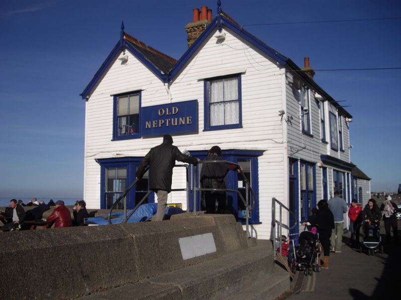
The Old Neptune
Public House
TR 16 NW 4/150
II
2.
Mid C19 building, weatherboarded. Slated roof. Sash windows with large squares.
2 storeys.
Listing NGR: TR1037066525
External links are from the relevant listing authority and, where applicable, Wikidata. Wikidata IDs may be related buildings as well as this specific building. If you want to add or update a link, you will need to do so by editing the Wikidata entry.


Other nearby listed buildings
