Approximate Location Map
Large Map »
Latitude: 51.3487 / 51°20'55"N
Longitude: 1.0398 / 1°2'23"E
OS Eastings: 611779
OS Northings: 165451
OS Grid: TR117654
Mapcode National: GBR TX7.CPX
Mapcode Global: VHKJR.ZC2G
Plus Code: 9F3382XQ+FW
Entry Name: Little Millstrood
Listing Date: 20 May 1977
Grade: II
Source: Historic England
Source ID: 1336884
English Heritage Legacy ID: 170848
ID on this website: 101336884
Location: South Street, Canterbury, Kent, CT5
County: Kent
District: Canterbury
Electoral Ward/Division: Gorrell
Parish: Non Civil Parish
Built-Up Area: Whitstable
Traditional County: Kent
Lieutenancy Area (Ceremonial County): Kent
Tagged with: Architectural structure
MILLSTROOD ROAD
1.
5273
(North Side)
No 128
(Little Millstrood)
TR 16 NW 4/31
II
2.
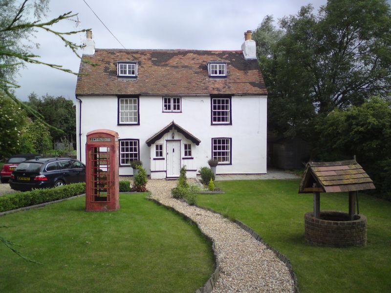
C18 house altered by having been refaced with roughcast, 2 storeys and attic.
3 windows. 2 dormers. Tiled roof. Windows in moulded architrave surrounds.
Glazing bars intact. Modern porch.
Listing NGR: TR1177965451
External links are from the relevant listing authority and, where applicable, Wikidata. Wikidata IDs may be related buildings as well as this specific building. If you want to add or update a link, you will need to do so by editing the Wikidata entry.


Other nearby listed buildings
