Approximate Location Map
Large Map »
Latitude: 51.3568 / 51°21'24"N
Longitude: 1.0247 / 1°1'28"E
OS Eastings: 610688
OS Northings: 166313
OS Grid: TR106663
Mapcode National: GBR TX1.V70
Mapcode Global: VHKJR.Q526
Plus Code: 9F33924F+PV
Entry Name: 5A, 7 and 9, Oxford Street
Listing Date: 20 May 1977
Grade: II
Source: Historic England
Source ID: 1336885
English Heritage Legacy ID: 170853
ID on this website: 101336885
Location: Whitstable, Canterbury, Kent, CT5
County: Kent
District: Canterbury
Electoral Ward/Division: Gorrell
Parish: Non Civil Parish
Built-Up Area: Whitstable
Traditional County: Kent
Lieutenancy Area (Ceremonial County): Kent
Tagged with: Building
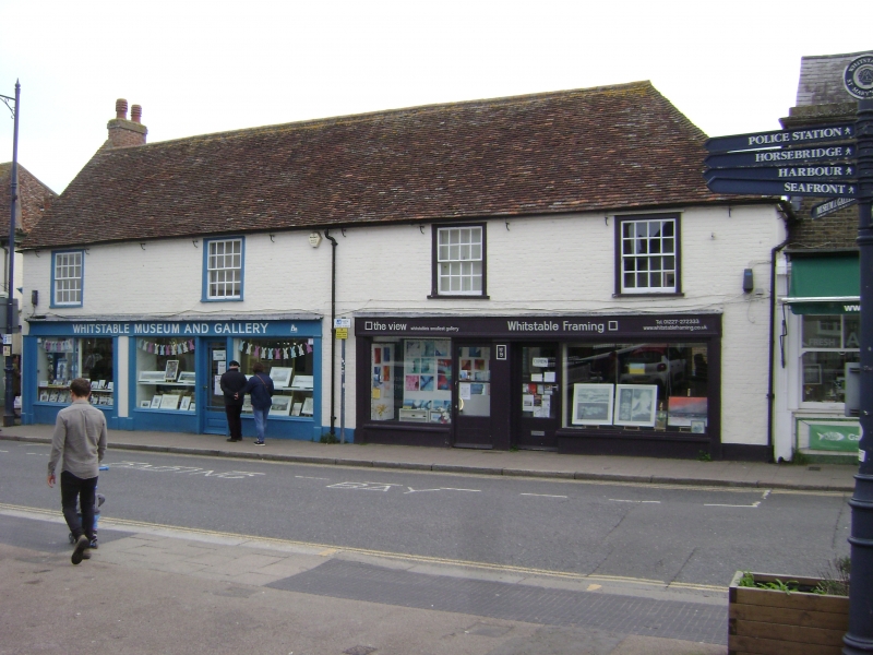
OXFORD STREET
1.
5273
(East Side)
Nos 5A, 7 and 9
TR 1066 SE 2/162
II GV
2.
Range of mid C18 brick buildings, 2 storeys with whitened walls and clay plain
tiled roof. 4 windows first floor with original glazing. Modern shop fronts.
Listing NGR: TR1068866313
External links are from the relevant listing authority and, where applicable, Wikidata. Wikidata IDs may be related buildings as well as this specific building. If you want to add or update a link, you will need to do so by editing the Wikidata entry.


Other nearby listed buildings
