Approximate Location Map
Large Map »
Latitude: 51.3549 / 51°21'17"N
Longitude: 1.025 / 1°1'29"E
OS Eastings: 610719
OS Northings: 166097
OS Grid: TR107660
Mapcode National: GBR TX1.VB9
Mapcode Global: VHKJR.Q67Q
Plus Code: 9F33923F+WX
Entry Name: 70, Oxford Street
Listing Date: 20 May 1977
Grade: II
Source: Historic England
Source ID: 1084908
English Heritage Legacy ID: 170858
ID on this website: 101084908
Location: Whitstable, Canterbury, Kent, CT5
County: Kent
District: Canterbury
Electoral Ward/Division: Gorrell
Parish: Non Civil Parish
Built-Up Area: Whitstable
Traditional County: Kent
Lieutenancy Area (Ceremonial County): Kent
Tagged with: Building
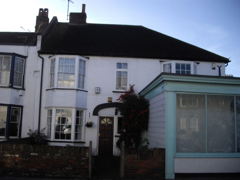
1. OXFORD STREET
5273
(West Side)
No 70
TR 1066 SE 2/175
II
2.
Early C19 doable fronted building, part modern shop front. Painted brick and modern
tiled roof. Glazing bars intact to windows. Door benewth large elliptical arch.
Listing NGR: TR1071966097
External links are from the relevant listing authority and, where applicable, Wikidata. Wikidata IDs may be related buildings as well as this specific building. If you want to add or update a link, you will need to do so by editing the Wikidata entry.


Other nearby listed buildings
