Approximate Location Map
Large Map »
Latitude: 51.214 / 51°12'50"N
Longitude: 1.1523 / 1°9'8"E
OS Eastings: 620258
OS Northings: 150808
OS Grid: TR202508
Mapcode National: GBR TYY.XV2
Mapcode Global: VHLGV.XRK7
Plus Code: 9F336572+HW
Entry Name: Footbridge over Ford
Listing Date: 14 March 1980
Grade: II
Source: Historic England
Source ID: 1111752
English Heritage Legacy ID: 170927
ID on this website: 101111752
Location: Out Elmstead, Canterbury, Kent, CT4
County: Kent
District: Canterbury
Civil Parish: Barham
Traditional County: Kent
Lieutenancy Area (Ceremonial County): Kent
Tagged with: Footbridge
1.
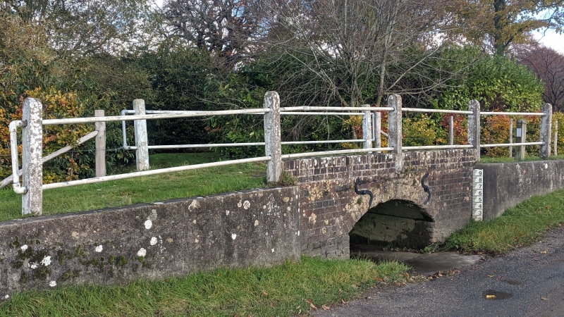
5273 BARHAM OUT ELMSTEAD LANE
(north side)
Footbridge over Ford
TR 2050 24/54
II GV
2.
C18 brick with modern coping. A small footbridge with segmental archway.
Listing NGR: TR2025850808
External links are from the relevant listing authority and, where applicable, Wikidata. Wikidata IDs may be related buildings as well as this specific building. If you want to add or update a link, you will need to do so by editing the Wikidata entry.


Other nearby listed buildings
