Approximate Location Map
Large Map »
Latitude: 51.2149 / 51°12'53"N
Longitude: 1.1547 / 1°9'16"E
OS Eastings: 620417
OS Northings: 150923
OS Grid: TR204509
Mapcode National: GBR TYY.QS2
Mapcode Global: VHLGV.YQSH
Plus Code: 9F336573+XV
Entry Name: Black Mill Cottage
Listing Date: 14 March 1980
Grade: II
Source: Historic England
Source ID: 1111912
English Heritage Legacy ID: 170931
ID on this website: 101111912
Location: Out Elmstead, Canterbury, Kent, CT4
County: Kent
District: Canterbury
Civil Parish: Barham
Traditional County: Kent
Lieutenancy Area (Ceremonial County): Kent
Tagged with: Cottage
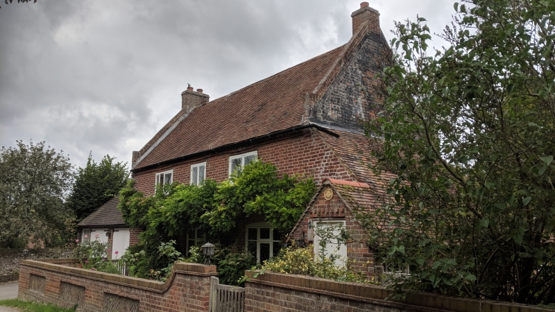
1.
5273 BARHAM OUT ELMSTEAD LANE
(north side)
Black Mill Cottage
TR 2050 24/56
II GV
2.
Cl8 Cottage of two storeys in red and blue brick with tile roof with brick
coped gable ends and stacks at gable ends. Diagonal-set brick eaves cornice.
Three windows, casements, above 3 similar with segmental arches and modern
wood mullions and transoms. Modern brick porch and penticed extension of one
storey.
Listing NGR: TR2041750923
External links are from the relevant listing authority and, where applicable, Wikidata. Wikidata IDs may be related buildings as well as this specific building. If you want to add or update a link, you will need to do so by editing the Wikidata entry.


Other nearby listed buildings
