Approximate Location Map
Large Map »
Latitude: 51.2594 / 51°15'33"N
Longitude: 1.0041 / 1°0'14"E
OS Eastings: 609703
OS Northings: 155424
OS Grid: TR097554
Mapcode National: GBR SWV.W50
Mapcode Global: VHKK4.CL6X
Plus Code: 9F337253+QM
Entry Name: Chartham Corn Mill
Listing Date: 14 March 1980
Grade: II
Source: Historic England
Source ID: 1085672
English Heritage Legacy ID: 171057
ID on this website: 101085672
Location: Shalmsford Street, Canterbury, Kent, CT4
County: Kent
District: Canterbury
Civil Parish: Chartham
Traditional County: Kent
Lieutenancy Area (Ceremonial County): Kent
Tagged with: Building
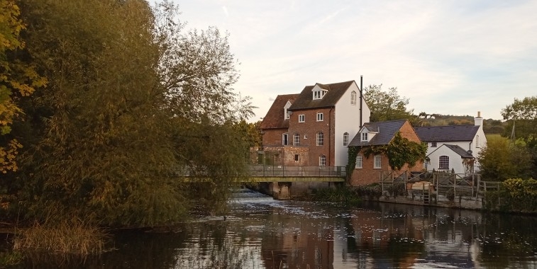
1.
5273 CHARTHAM ASHFORD ROAD
Chartham Corn Mill
TR 05 NE 7/222
II
2.
Mid C19 L-shaped mill. Three storeys and attic in gable end. Built of painted
brick, the gable end weather-boarded. Tiled roof. In the gable end is a small
gabled projection containing one window with a hoist below it. Five casement
windows. The former mill house Corn Mill House which adjoins is a late C19
building not of special architectural interest.
Listing NGR: TR1068655272
External links are from the relevant listing authority and, where applicable, Wikidata. Wikidata IDs may be related buildings as well as this specific building. If you want to add or update a link, you will need to do so by editing the Wikidata entry.


Other nearby listed buildings
