Approximate Location Map
Large Map »
Latitude: 51.3298 / 51°19'47"N
Longitude: 1.4154 / 1°24'55"E
OS Eastings: 638025
OS Northings: 164501
OS Grid: TR380645
Mapcode National: GBR X0L.JNS
Mapcode Global: VHMCW.HT3Z
Plus Code: 9F338CH8+W5
Entry Name: 2, Paragon Street
Listing Date: 4 February 1988
Grade: II
Source: Historic England
Source ID: 1085324
English Heritage Legacy ID: 171927
ID on this website: 101085324
Location: Ramsgate, Thanet, Kent, CT11
County: Kent
District: Thanet
Civil Parish: Ramsgate
Built-Up Area: Ramsgate
Traditional County: Kent
Lieutenancy Area (Ceremonial County): Kent
Tagged with: Building
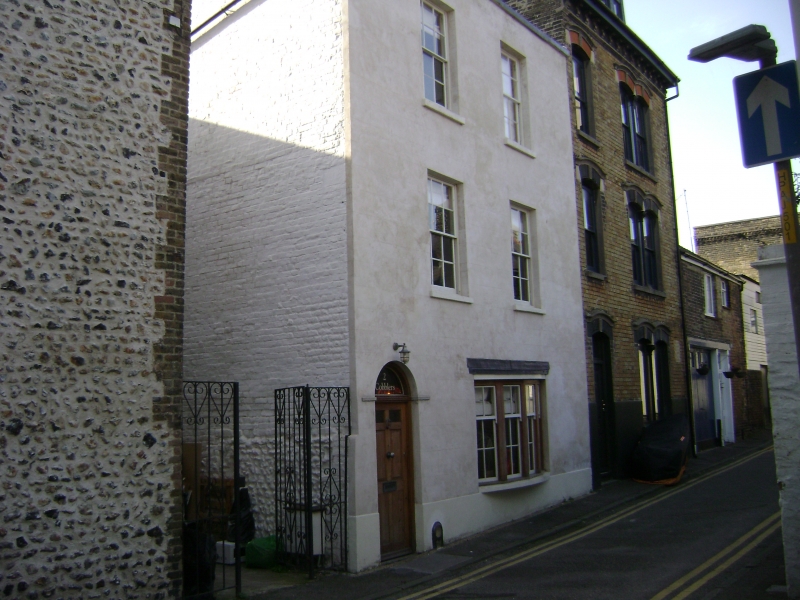
RAMSGATE PARAGON STREET
TR 3864 NW + 3864 SW
(south side)
13+19/294 No. 2
GV II
House. Circa 1830. Rendered with slate roof. Three storeys on plinth
with parapet. Two glazing bar sashes to 2nd and 1st floors, with
cambered heads, and shallow bowed oriel to ground floor, with half-
glazed door to left with semi-circular fanlight in moulded and keyed
surround, with moulded jambs. Included for group value.
Listing NGR: TR3802564501
External links are from the relevant listing authority and, where applicable, Wikidata. Wikidata IDs may be related buildings as well as this specific building. If you want to add or update a link, you will need to do so by editing the Wikidata entry.


Other nearby listed buildings
