Approximate Location Map
Large Map »
Latitude: 51.3293 / 51°19'45"N
Longitude: 1.4145 / 1°24'52"E
OS Eastings: 637963
OS Northings: 164452
OS Grid: TR379644
Mapcode National: GBR X0L.QF7
Mapcode Global: VHMCW.GVM9
Plus Code: 9F338CH7+PQ
Entry Name: 20, Paragon Street
Listing Date: 4 February 1988
Grade: II
Source: Historic England
Source ID: 1367070
English Heritage Legacy ID: 171928
ID on this website: 101367070
Location: Ramsgate, Thanet, Kent, CT11
County: Kent
District: Thanet
Civil Parish: Ramsgate
Built-Up Area: Ramsgate
Traditional County: Kent
Lieutenancy Area (Ceremonial County): Kent
Tagged with: Building
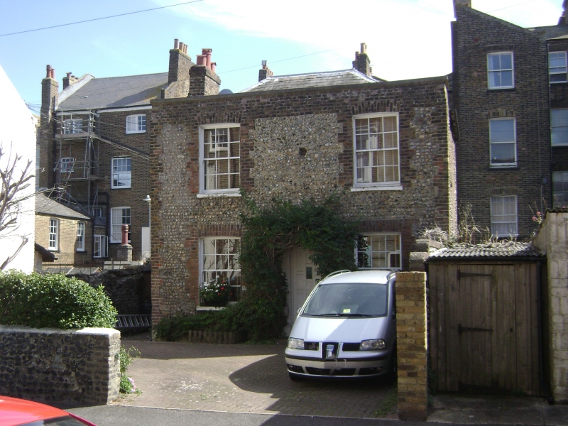
RAMSGATE PARAGON STREET
TR 3764 SE
(south side)
18/295 No. 20
GV II
House. Circa 1830. Coursed flint with brick dressings and with slate
roof. Two storeys and parapet to hipped roof with stacks to end left
and truncated to end right. Regular fenestration of 2 glazing bar sashes
with cambered heads on each floor and central door of 6 panels with
semi-circular fanlight in gauged surround.
Listing NGR: TR3796364452
External links are from the relevant listing authority and, where applicable, Wikidata. Wikidata IDs may be related buildings as well as this specific building. If you want to add or update a link, you will need to do so by editing the Wikidata entry.


Other nearby listed buildings
