Approximate Location Map
Large Map »
Latitude: 51.446 / 51°26'45"N
Longitude: 0.2061 / 0°12'21"E
OS Eastings: 553403
OS Northings: 174194
OS Grid: TQ534741
Mapcode National: GBR TN.NLZ
Mapcode Global: VHHNT.JX9D
Plus Code: 9F32C6W4+9C
Entry Name: Grammar School
Listing Date: 25 September 1975
Grade: II
Source: Historic England
Source ID: 1086055
English Heritage Legacy ID: 172112
ID on this website: 101086055
Location: Dartford, Kent, DA1
County: Kent
District: Dartford
Electoral Ward/Division: West Hill
Parish: Non Civil Parish
Built-Up Area: Bexley
Traditional County: Kent
Lieutenancy Area (Ceremonial County): Kent
Church of England Parish: Dartford Christ Church
Church of England Diocese: Rochester
Tagged with: Grammar school School building Academy school Secondary school Boys' school
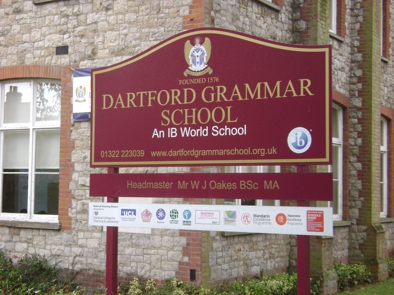
1. DARTFORD ROAD
5274 (South Side)
Grammar School
TQ 5374 1/27
II
2.
1862-6 by A W B1omfield. 1 to 2 storeys built of ragstone with red brick dressings.
Tiled roof. Buttresses. Octagonal turret with spire above. Gable. Dormers.
Mullioned and transomed casements.
Listing NGR: TQ5340374194
External links are from the relevant listing authority and, where applicable, Wikidata. Wikidata IDs may be related buildings as well as this specific building. If you want to add or update a link, you will need to do so by editing the Wikidata entry.


Other nearby listed buildings
