Approximate Location Map
Large Map »
Latitude: 51.4438 / 51°26'37"N
Longitude: 0.2244 / 0°13'27"E
OS Eastings: 554680
OS Northings: 173996
OS Grid: TQ546739
Mapcode National: GBR VH.TDX
Mapcode Global: VHHNT.TZZ1
Plus Code: 9F32C6VF+GP
Entry Name: St Edmund's Chartered Churchyard
Listing Date: 25 September 1975
Grade: II
Source: Historic England
Source ID: 1086024
English Heritage Legacy ID: 172116
ID on this website: 101086024
Location: New Town, Dartford, Kent, DA1
County: Kent
District: Dartford
Electoral Ward/Division: Newtown
Parish: Non Civil Parish
Built-Up Area: Bexley
Traditional County: Kent
Lieutenancy Area (Ceremonial County): Kent
Church of England Parish: Dartford Holy Trinity
Church of England Diocese: Rochester
Tagged with: Building
1. EAST HILL
5274 (North Side)
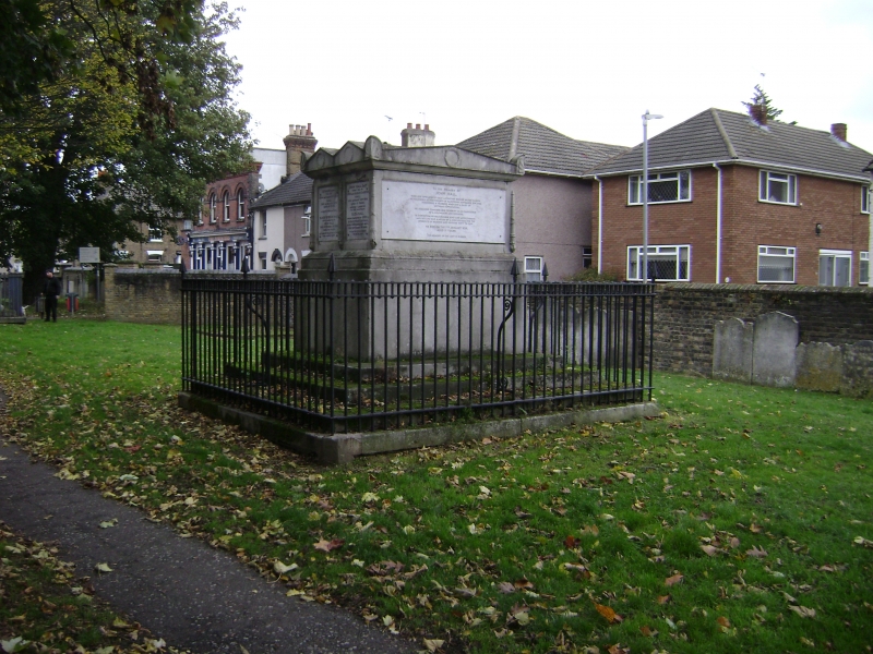
St Edmund's
Chartered Churchyard
TQ 5474 2/64
TQ 5473 3/64
II
2.
This churchyard contains 9 C18 to Mid C19 stone table tombs, some good C18 head-
stones with cherub, skull or hourglass motifs and some early C19 headstones with
urns or other Classical Revival motifs.
Listing NGR: TQ5466673993
External links are from the relevant listing authority and, where applicable, Wikidata. Wikidata IDs may be related buildings as well as this specific building. If you want to add or update a link, you will need to do so by editing the Wikidata entry.


Other nearby listed buildings
