Approximate Location Map
Large Map »
Latitude: 51.4451 / 51°26'42"N
Longitude: 0.2139 / 0°12'49"E
OS Eastings: 553946
OS Northings: 174115
OS Grid: TQ539741
Mapcode National: GBR TN.QL6
Mapcode Global: VHHNT.NYF2
Plus Code: 9F32C6W7+2G
Entry Name: 53 and 55, Spital Street
Listing Date: 25 September 1975
Grade: II
Source: Historic England
Source ID: 1115767
English Heritage Legacy ID: 172144
ID on this website: 101115767
Location: Dartford, Kent, DA1
County: Kent
District: Dartford
Electoral Ward/Division: Town
Parish: Non Civil Parish
Built-Up Area: Bexley
Traditional County: Kent
Lieutenancy Area (Ceremonial County): Kent
Church of England Parish: Dartford Holy Trinity
Church of England Diocese: Rochester
Tagged with: Building
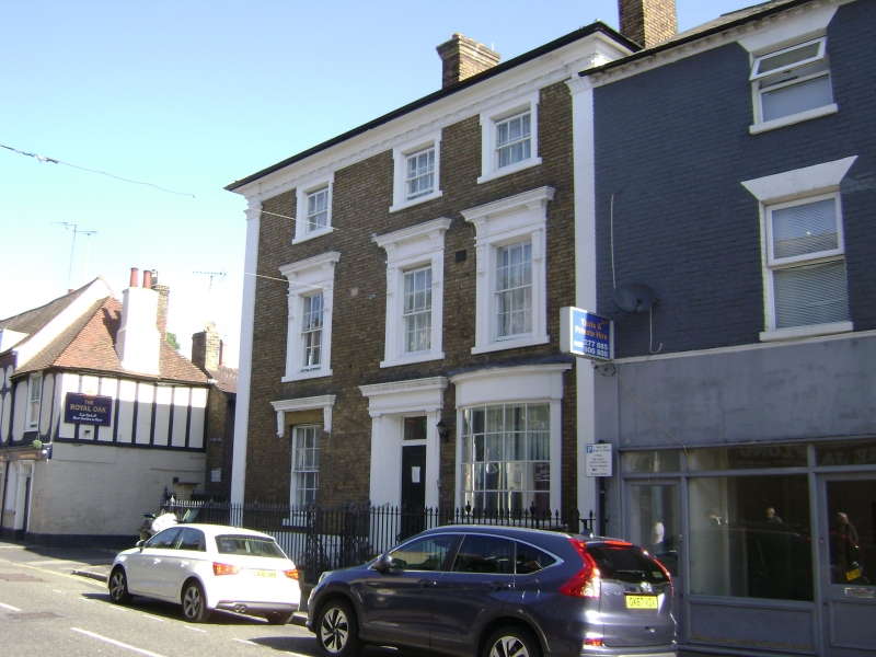
1. SPITAL STREET
5274 (North Side)
Nos 53 and 55
TQ 5374 1/57
II GV
2.
Mid C19. 3 storeys and basement stock brick. Hipped pantiled roof. 3 sashes
with glazing bars intact in italianate architraves. Pilasters rise through all
storeys. Doorcase with cornice and pilasters. Later curved bow inserted on front
elevation.
Nos 53 to 57 (odd) form a group.
Listing NGR: TQ5394674116
External links are from the relevant listing authority and, where applicable, Wikidata. Wikidata IDs may be related buildings as well as this specific building. If you want to add or update a link, you will need to do so by editing the Wikidata entry.


Other nearby listed buildings
